Bostra

History

Roman Ruins

  • The Roman city of Bosra is a major archeological site containing multiple ruins:
    • Roman Theatre, almost intact.
    • The West Gate
    • Kharaba Roman Bridge (nearby)
    • Gemarrin Roman Bridge (nearby)

Museums

  • Bosra Museum
    • It is located in the Roman Theatre of Bosra.
    • It holds a collection of artefacts excavated from Bosra including mosaics and tombstones.

Roman Roads


Bostra Roman Ruins, Bosra

Godavaya

  • Godavaya, also known as Godawaya, was an ancient Port, on the Indian Ocean in the South of Sri Lanka.
  • It was in the administrative region of Ruhunu Rata, ruled by the King’s brother at his Capital of Magampura.

History

  • Godavaya operated from the 1st century BCE to 10th century CE.
  • It was an important Port on the Silk Road.
  • Ships came from China and the Goods were transhipped to the Red Sea and the Mediterranean.

Finds

  • A Temple
    • Still standing today, the Buddhist Temple is called Gotha Pabbatha Rajamaha Vihara, and was built in the 2nd century BCE, on the rock overlooking the harbour.
  • A Customs House
    • This was built to one side of the Temple.
  • An Inscription
    • from King Gajabahu I’s Reign (c.114-136 CE) mentions the name of the Port as Goda-pavata Patana.
    • It shows Port Dues were collected from Godawaya Harbour and a portion went to the local Temple of Godapawath.
    • Clay Seals bearing a Lion were used to show Payment had been made.
  • Statue of Buddha
    • Which is 11 ft 6″ (3.5 m) high, along with two smaller Boddhisattva statues.
  • 75,000 Late Roman Coins
    • These have been excavated from earthen containers in the area.
  • Persian and Chinese pottery has also been found.

Godavaya Shipwreck

  • The Godavaya Shipwreck, dating from the first century BCE or CE, was found near the ancient port of Godavaya in Sri Lanka. It was possibly heading towards Egypt.
  • The cargo consisted of:
    • Iron and Copper Ingots
    • Blue Green and Black Glass Ingots from southern India
    • Pottery


Godawaya Harbour

Chateau Royal de Collioure

Collioure

  • Collioure is a pretty port town in the Region of Pyrenees-Orientales of southeastern France, and is located a few miles from the Spanish Frontier.
  • The area produces red, white and rose wines called Collioure AOC and a dessert wine called Banyuls AOC. Collioure is noted for its massive fortress and an annual firework display held every August.

Chateau Royal de Collioure

  • Collioure harbour is dominated by a massive fortress which has existed under four different regimes since at least the 13th century CE.
  • In 1209 CE The Knights Templar built a fortress.
  • During the 13-14th century, the fortress belonged to the Kings of Majorca.
  • In the 16th century, Charles V, King of Spain rebuilt the fortress.
  • In 1642, the French King Louis XIII besieged and conquered the fortress and it has remained in French ownership ever since. The real life D’Artagnan, who was Captain of the King’s Musketeers, fought in this siege along with an army of 10,000 men.

Roman Roads

  • The Romans conquered the area in 121 BCE and built the Via Domitia, first Roman Road in Gaul which ran for 482 miles (777km) from Italy to Spain.
  • Roman Collioure was on the coastal section of the Via Domitia leading to the Spanish Border.


Collioure

Conical Tomb of Alexander the Great

Gold Coffin filled with White Honey

Location

  • The location of Alexander’s Tomb is now lost.
  • The Tomb was known as a major landmark in the Greco-Roman world for 600 years. The Romans visited his tomb as part of the Roman Grand Tour.


Alexandria

Sahel African Kingdoms

  • The Sahel is the area south of the Sahara where rainfall vegetation starts. The Sahel African Kingdoms traded across the Sahara with the Roman Empire.
  • Camel Caravans travelled from Tripolitana and Morocco along Saharan Trade Routes that ran through the Fezzan and on to the Sahel.

Agisymba

  • Marinus of Tyre constructed a World Map, with the southernmost Parallel passing through the Land of Agisymba and called it the Parallel of Agisymba.
  • Acccording to Marinus of Tyre and Ptolemy, Agisymba was a country four months travel south through the Fezzan, with large animals and high mountains, thought to have been situated around Lake Chad.
  • Between 82-93 CE, the King of the Garamantes claimed Lordship over Agisymba.


Lake Chad

Monsoon

  • The Monsoon is a Tropical Wind that changes direction every six months due to the heating or cooling of the land masses.
  • It affects Africa, the Indian Ocean, India and Australia. The Monsoon continually varies in rainfall, and can cause either drastic flooding or severe drought.

Monsoon Season in the Indian Ocean

  • The Southwest Monsoon bring heavy rains to India, and then reverses direction bringing rains mainly to the east coast of India.
    1. The Southwest Monsoon lasts from May to September.
    2. The Northeast Monsoon lasts from October to March.

The Cyclone season

  • In the North Indian Ocean, comprising the Arabian Sea and the Bay of Bengal, the Cyclone Season runs from May to December.
  • There are two Cyclone Seasons with May and December producing the most powerful Cyclones.
    1. Pre-Monsoon, April to June.
    2. Post-Monsoon, October to December.
  • Storms do not develop into Cyclones during July and August.
  • The Cyclones start from Latitude 7 degrees North and track Northwest, sometimes reaching up to 30 Degrees North,  their most destructive capability between 10-15 Degrees North.
  • Cyclones die out when they reach a landmass and usually do not occur within 5 degrees either side of the Equator.

Roman Sailing Season

  • The southwest Monsoons brought Roman ships emerging from the Red Sea to India in around 45 days.
  • The northeast Monsoons sent the ships home from India back to the Red Sea.

Periplus of the Erythraean Sea

  • This is a 1st century CE nautical guide that describes two main sea routes using the Monsoon and was probably written by a merchant from Alexandria.
  • It starts at Berenice in Egypt and describes one Route via the Red Sea across to India and the Ganges, and another Route from Berenice down to the East Coast of Africa (Azania).

The Southwest Monsoon

  • It was known as the ‘Hippalus’ to the Romans, and decribes the Summer Monsoon from May to September.
  • It collects moisture over the Arabian Sea and reaches India where it ‘bursts’ over the western coast around the first of June, covering all of India by around the 15th July. It then starts to leave India from the 1st of September and has left by the 1st of October.
  • The winds blow from the Indian Ocean onto the western coast of India and Sri Lanka.
  • When they reach the Western Ghats mountain range, their moisture is released as a continuous downpour over India.
  • The Himalayas force the Monsoon Winds to release their moisture, and block them from reaching China.

The Northeast Monsoon or Retreating Monsoon

  • This is also known as the Winter Monsoon and runs from December to March.
  • As the Indian subcontinent cools in September, cool air is drawn back in the reverse direction.
  • This is known as the Northeast Monsoon, which reverses direction and collects moisture over the Bay of Bengal. It usually ‘bursts’ over the eastern coast of India around the 20th of October, lasting up until the 10th of December.
  • The winds blow over the Eastern Ghats mountain range, but only the Monsoon that has passed over the Bay of Bengal picks up moisture, and only Andhra Pradesh and Tamil Nadu receive rain during the winter.

Sri Lanka

  • Sri Lanka experiences a slightly different Monsoon Season, in that it has four distinct Monsoon Seasons:
    1. The First Inter Monsoon Season (March to April).
      • This is a period of unsettled weather with thunderstorm type rain falling in the afternoon or evening.
    2. The Southwest Monsoon Season (Summer Monsoon – May to September)
    3. The Second Inter Monsoon Season (October to November).
      • This is a also period of unsettled weather with thunderstorm type rain falling in the afternoon or evening.
    4. The Northwest Monsoon Season (Winter Monsoon – December to March)

Navigating the Northern Indian Ocean

  • The South West Monsoon blows during May to September or October, from the Gulf of Aden to the Andaman Sea off Thailand. The Winds are consistent and strong, blowing between Force 7 to 8, and are hot and often hold torrential rain.
  • The North Eastern Monsoon blows during November to March, in the reverse direction. The Wind speed is lighter blowing between Force 4 to 5. The Winds are generally cooler, drier and less consistent than the S.W. Monsoon.
  • The Ocean Currents in the Northern Indian Ocean, usually follow the prevailing Monsoon and are between 0.5 to 1 knot. This applies to the Somali Current, which follows and intensifies in the direction of each Monsoon.

Navigating the East African Coast

  • From February to September:
    • The Somali Current flows Northeastward in a band 30-60 miles (50-100km) wide, along the East Coast of Africa.
    • During the Southwest Monsoon, which blows at a steady 30mph (48kph) between May and June, the Current is at its strongest flow.
    • Between June and August, this intense Current produces two main Eddies that rotate clockwise, the Great Whirl and a secondary Eddy known as the Socotra Gyre.
  • From December to April:
    • During the Northeast Monsoon, the Somali Current reverses to become a Southward Flow, reaching up to Latitude 10 degrees North, which includes most of the Somali Coastline.
    • The Current is at its strongest in January. However, the current flows north between Socotra and the Horn of Africa.

Navigating the Southern Indian Ocean

  • From 4 to 25 degrees South, the prevailing winds are the South Eastern Trade Winds which blow all year round, at Force 4 to 5. With the exception of the Mozambique Channel where the winds increase.
  • The South Equatorial Current flows in a Westerly or Southwesterly direction south of the Equator at 0.5 to 1 knot.
  • In the South Western Indian Ocean, there are generally 8 Tropical Storms and 4 Cyclones per year.


The North Indian Ocean

Great Wall of China

  • The Great Wall of China is a series of connected Walls made of rammed Earth or Mud, Brick and Stone, which run along China’s northern border in an east-west direction. It is a Unesco World Heritage Site.
  • During the Ming Dynasty (1368-1644 CE) the Walls ran for a distance of 5,500 miles (8,800 km). Today the entire length is considered to be 13,171 miles (21,196 km).

History

  • In 700 BCE the first walls were constructed but did not connect.
  • In 220-206 BCE, the first Emperor of China, Qin Shi Huang, founder of the Qin Dynasty, ordered the Wall to be connected and reinforced along his entire northern frontier, at the cost of hundreds of thousands of lives.
  • This was to prevent intrusions by the Xiongnu to the north.
  • The wall was reconstructed during the Ming Dynasty (1368-1644 CE).
  • It ran from Lop Lake in the west to the Port of Shanhaiguan on the Yellow Sea, in the east.
  • It ran for 5,500 miles (8,800 km) consisting partly of Wall and partly of natural features, such as Rivers, Mountains and Dykes.

The Three Passes

  • The Great Wall runs through three Passes which are:
    • Juyong Pass
      • Located in the 11 miles (18km) long Guangou Valley.
    • Jiayu Pass
      • Located in the 4 mile (6km) long Hexi Corridor.
      • This Pass was on the Silk Road.
    • Shanhai Pass
      • Located in the Liaoxi Corridor, a long narrow Plain along the Bohai Sea, it is the starting point of the eastern end of the Great Wall.

Built as a Road

  • The Wall was a built as a road. In places, two carts could pass side by side.

A Military Frontier

  • The Wall was protected by soldiers manning a line of watchtowers.
  • These were connected to Forts using a signaling system of smoke and fire signals.
  • The Wall had Battlements and the towers had doors which closed the path below.

Silk Road

  • The Great Wall and the Silk Road complement each other then join at the Jiajuguan Pass in Gansu and continue westwards together via Yumenguan and Yangguan.


Great Wall of China

Brenner Pass

  • The Brenner Pass is one of the main Passes through the Eastern Alps and forms the frontier between Italy and Austria.
  • It has an altitude of 4,495 ft (1,370m). During the Roman Empire it was used to reach Augsburg.

Roman Road (140’s CE)

  • In the second century CE, a second Roman Road was built to the east of the Via Claudia Augusta, to reach Augsburg using the Brenner Pass.
  • Despite the Germanic invasions, the Brenner Pass remained under Roman control until the Fall of the Western Empire (476 CE).

Via Claudia Augusta (15 BCE)


Brenner Pass


Roman Prime Meridian

Ptolemy’s Prime Meridian and the Canary Islands

In Ptolemy's Geographia (c. 150 CE), the Roman Prime Meridian—also known as the Zero Degree Longitude—was centered not on Rome, but on Mount Teide in Tenerife, part of the Canary Islands.

Mount Teide is located at 16°38′22″ west of the modern Greenwich Prime Meridian. This placement reflects ancient navigational practices and the mathematical limitations of longitude calculation in the Roman world.

Why the Prime Meridian Did Not Pass Through Rome

Contrary to modern assumptions, the Zero Meridian did not pass through Rome. In the ancient world, maritime navigation did not use negative longitude values. As a result, the Prime Meridian needed to be positioned west of all known lands, allowing longitude to be measured using only positive degrees from 0 to 360.

By placing the Zero Meridian near the western edge of the known world—close to the Canary Islands—Roman geographers ensured consistent and practical navigation across the Mediterranean Sea and beyond.

The Modern Prime Meridian

Today, the internationally recognized Prime Meridian is located at the Royal Observatory in Greenwich, London, England. This standard was adopted in the late 19th century and replaced the many regional meridians previously used by European nations.

How Longitude Was Calculated in the Ancient World

In Roman times, longitude was calculated by comparing the timing of Lunar Eclipses observed in different cities. By measuring the time difference between the same eclipse at various locations, astronomers could estimate longitudinal separation—an innovative method long before the invention of accurate mechanical clocks.

Roman Sources Describing the Canary Islands

Pliny the Elder (23–79 CE)

Pliny the Elder recorded an expedition around 50 BCE to the Fortunate Islands, led by Juba II of Mauretania. He described the discovery of ruins from large structures, although he did not mention the Guanche, the indigenous people of the Canary Islands.

Plutarch (46–c.120 CE)

In Life of Sertorius, Plutarch described two islands in the Atlantic Ocean off the coast of Africa, known as the Fortunate Islands. He suggested they could be Elysium, the paradise of Greek Mythology. His description of the climate closely matches that of the Canary Islands.

El Hierro and the Prime Meridian

El Hierro, the westernmost of the Canary Islands, was considered the furthest west point of the Old World prior to the discovery of the Americas in 1492.

For more than 500 years, El Hierro served as the Prime Meridian for several European nations. France officially adopted it in 1634, while the Netherlands used Mount Teide as their Prime Meridian from the 1640s until 1826.

Roman Astronomy and Ptolemy

The greatest astronomer of Roman Astronomy was Claudius Ptolemy (c. 90–168 CE). His monumental work, the Almagest, presented a comprehensive star catalogue that:

  • Predicted planetary positions at any time
  • Catalogued 48 constellations
  • Served as the definitive astronomical reference for over 1,400 years

Although Ptolemy supported a geocentric (Earth-centered) model of the universe, his work dominated scientific thought until 1543, when Copernicus introduced the heliocentric system.


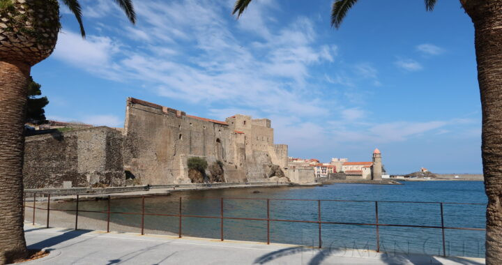
Roman Prime Meridian, Mount Teide, Tenerife

Xiongnu

Xiongnu: Overview

  • The Xiongnu was a Steppe Empire (209 BCE-329 CE), consisting of a Nomadic Confederation located in present day Mongolia.
  • The Xiongnu alternately fought wars with China or received Tribute. Between 220-206 BCE the Qin Dynasty rebuilt and connected Great Wall of China to prevent Xiongnu incursions.

Xiongnu: Description

  • The Xiongnu formed themselves into an Empire in 209 BCE under Modu Chanyu, possibly in response to the unification of China under the Qin Dynasty in 221 BCE.
  • The frontier between the Xiongnu and China was defined by the Great Wall of China.
  • The Xiongnu relied on Tribute from China to maintain its confederation.

The Xiongnu divide into two States (48-155 CE)

  • Between 48-155 CE, the Xiongnu were divided into the Northern Xiongnu and the Southern Xiongnu, and fought each other.
  • Some historians have put forward a theory that the Northern Xiongnu migrated westward and either merged with or became the Huns.
  • From 50 CE onwards the Southern Xiongnu became a Tributary State to the Han Dynasty of China, enabling them to keep the Southern Xiongnu in check.

Ban Chao defeats the Western Xiongnu (97 CE)

  • Ban Chao, the senior General of the Han Army, sent 70,000 men against the western region Xiongnu, and ended their raids on the Silk Road, resulting in their subjugation.

Ban Chao sends Envoy to Rome (97 CE)

  • Ban Chao then sent his Envoy, Gan Ying, to Daquin (Rome).
  • Gan Ying reached Hecatompylos and the court of the King of Parthia, Pacorus II (78-110 CE).
  • But after leaving Hecatompylos, he only reached Charax Spasinou, on the Arabian Gulf.
  • The Chinese delegation turned back after being advised by the Parthians it would take too long to get to Rome.
  • They returned to China and handed a complete report, compiled by the Parthians, on the Roman Empire, to the Emperor He of Han (88-105 CE).


Mongolia