Conimbriga Monographic Museum, Portugal

Conimbriga

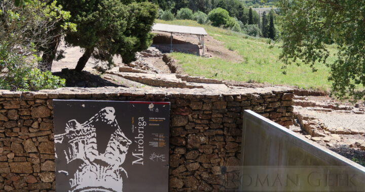
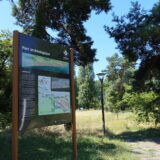
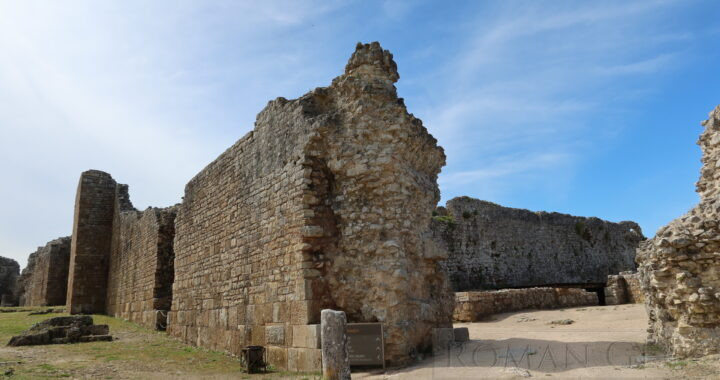
  • Conimbriga is the best preserved Roman city in Portugal and was made a National Monument of Portugal in 1910.
  • It is located 123 miles (198 km) north of Lisbon and 9 miles (16 km) south of Coimbra at Condeixa-a-Velha in the Centro Region of Portugal.

History

  • It dates from between the 2nd century BCE to the 5th century CE, and became a Municipium between 69-79 CE and was in the Province of Lusitania.

Roman Sites

  • Roman Amphitheatre
  • Roman Aqueduct
  • Roman Basilica
  • Roman Baths
  • Roman Forum
  • Roman residential houses (Domus)
  • Roman Walls

Museums

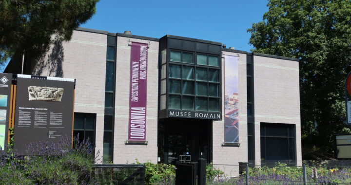
  • Conimbriga Ruins and Museum
    • The Museum is located on the Roman ruins of Conimbriga at Condeixa-a-Velha.

Roman Roads


Conimbriga Roman Ruins at Condeixa-a-Velha

Avenches Roman Amphitheatre, Switzerland

Avenches

  • Avenches is a town located to the south of Lake Neuchatel in the Vaud Canton of Switzerland.
  • It was founded between 15-13 BCE as the Roman city of Aventicum and until 120 CE, it was the first capital of the Province of Raetia.

Roman Sites

  • The Roman Ruins of Aventicum:
    • Amphitheatre and Museum
    • Theatre
    • Temples
    • City Wall

Museums

Avenches Castle

  • Built in the 13th century, Avenches Castle was renovated in the Renaissance style during the 15th century.
Avenches Castle

Avenches Castle

Avenches Roman Amphitheatre and Museum, Switzerland

Elephantine Island

  • Elephantine Island is located in the river Nile opposite Aswan, Egypt.
  • The Ruins of several Temples, two Nilometers and the Aswan Museum are on the island. The Aswan Museum holds a collection of artefacts found on the island.

History

Ancient Egyptian Sites

  • Temple of Satet
    • As early as 3,000 BCE, there was a Temple of Satet.
    • The Ruins are still standing, along with the small Temple of Heqaib and a Step Pyramid.
  • Temple of Thutmose III
    • However, very little is left of the Temple of Thutmose III, the Temple of Amenhotep III and the Temple of Khnum as they were all dismantled.
  • Nilometer
    • Near the Temple of Satis is a corridor Nilometer with a flight of 99 stone stairs leading down to the Nile with the heights marked off along the stair wall in Hieroglyphs, Roman Numerals and in Arabic.
  • Nilometer
    • Another Nilometer exists at the southern end of the island near the Temple of Khnum.
    • This is a Basin that fills.

Museums

  • Aswan Museum
    • The museum is located on Elephantine Island and holds artefacts found from excavations all over the island.

The Ancient Egyptian Fort

  • The Ancient Egyptians maintained a Garrison at Elephantine, as this marked the southern Border of Egypt.
  • According to the Elephantine Papyri, this was manned by a contingent of Jewish Mercenaries during the period of the Babylonian Exile (587-539 BCE). They built their own Temple of Yahweh.

The Ivory Trade

  • The Island was also used as a warehouse for Ivory that came down the Nile from Africa.
  • The name Elephantine Island is possibly derived from the storage of elephant tusks here.

Navigation on the Nile

Nilometer

  • The Nilometer indicated the height of the Nile and measured the annual rise and fall of the Nile.
  • Records were kept from the time of the Pharaohs, enabling the Egyptian priests to announce the date of the first Nile Flood and the date of its maximum height.
  • Other Nilometers on the Nile:
    • One near Cairo
    • Another at Alexandria
    • Several located in various Temples along the banks of the Nile:
    • One at the Temple of Philae, at Philae Island.
    • One at the Temple of Kom Ombo, which had a Nilometer that consisted of a channel that led to a deep cylindrical well inside the Temple building.


Temple of Satet, Elephantine Island

Cherchell

  • Cherchell is a Mediterranean seaport town 55 miles (90km) west of Algiers in the Tipaza Province of Algeria, and was known to the Romans as first Lol and then Caesarea Mauretaniae.
  • It was the capital of first the Kingdom of Numidia, then the Roman Province of Mauretania Caesariensis.

History

Roman Sites

  • Theatre
  • Amphitheatre (rectangular, not oval)
  • Baths
  • Basilica
  • Forum
  • Column
  • Aqueduct
  • A copy of a Roman Fountain stands in Roman Square (the original is in the museum courtyard)

Group of Monuments Nearby

  • Royal Mausoleum of Mauretania
  • Other Monuments
    • from the Phoenician and Roman Periods lie along this road. They are a UNESCO World Heritage Site.

Museums

  • Archaeological Museum of Cherchell
    • Located at J55R+8FF, Cherchell.
    • The museum holds a collection of Finds excavated from Caesarea including fine mosaics, such as the Mosaic of the Vine workers.
    • It also holds marble sculptures such as the Bust of Cleopatra Selene II and a Roman Fountain with four lion heads in the museum courtyard.

Roman Roads


Cherchell, Algeria

Mirobriga is a well preserved Ruin of the Roman Town of Mirobriga

Mirobriga

  • Mirobriga is a well preserved Ruin of the Roman Town of Mirobriga Celticorum, located near Santiago do Cacem, 89 miles (143km) south of Lisbon, in the Lisbon-Alentejo Region of southwest Portugal.
  • It was in the Province of Lusitania.

Roman Sites

  • Roman Baths
  • Roman Bridge
  • Roman Forum
  • Roman Hippodrome (seating for 25,000 spectators)
  • Roman Mosaics

Museums

  • Museo de Santiago do Cacem
    • It is located at Praca Municipal, 7540-136 Santiago do Cacem.
    • This archeological museum holds Roman Finds from Mirobriga.

Roman Roads


Ruins of Mirobriga, Santiago do Cacem

Tripoli

  • Tripoli is a port and the capital city of Libya. It is also known as ‘Tripoli of the West’ to differentiate it from Tripoli in Lebanon.
  • It was the Roman city of Oea in Tripolitana.

History

  • Tripoli was the Roman city of Oea and formed the three cities of Tripolitana, along with Sabratha and Leptis Magna.
  • The city has remained continuously inhabited since it was founded by the Phoenicians in the 7th century BCE.
  • Unlike Sabratha and Leptis Magna, which ceased to be inhabited, Tripoli has almost no visible Roman Remains.

Roman Sites

  • The Arch of Marcus Aurelius in Oea, Tripoli.

Museums

  • Red Castle Museum
    • Located in the Red Castle, Tripoli.
    • The Assaraya Alhamra Museum or Red Castle Museum holds Archeological collections found in Libya that cover the whole historical period from the Phoenicians to the Modern Period.


Tripoli

Roman Museum of Lausanne-Vidy

Lausanne

  • Lausanne was founded as a Roman Fort called Lousanna in Raetia which developed into a town.

The Roman Sites

  • The Roman Remains are in a Park which is now the Roman Museum of Lausanne-Vidy.
Roman Museum of Lausanne-Vidy

Roman Museum of Lausanne-Vidy

Museums

Roman Museum of Lausanne-Vidy

Roman Museum of Lausanne-Vidy


Roman Museum of Lausanne-Vidy, Lausanne

Charax

History

  • The ruins of Charax today, are located between Yalta and Alupka.
  • The Roman Fortress city of Charax was built by Vespasian (69-79 CE) and held detachments from the Danube Legions.

Legion

The Site Today

  • Charax Fortress, Ruins
    • Houses (ruins)
    • Baths
    • Necropolis

Museums

  • Yalta Historical and Literary Museum
    • Located at Pushkinska St, 5. Yalta.
    • The museum contains artefacts excavated from Charax.


Charax

Trajan’s Canal

  • Trajan’s Canal was a Roman canal that connected the Nile at Cairo to the Red Sea at Suez.
  • It closely followed the course of the first canal started by the Pharaoh Sesostris who followed the Pelusiac arm of the Nile.

History of the Roman Suez Canal

  • Unlike today’s Suez Canal which starts at the Mediterranean Sea, the Roman Canal started at the Nile at Fort Babylon, Cairo, passing via Wadi Tumilat, then through Lake Timsah and the Bitter Lakes, before reaching the Red Sea at Clysma (Suez).
  • Starting in 112 CE, the Roman Canal was built by Trajan. This canal started in Cairo 37 miles (60 km) south of the Ptolemaic Canal.
  • The date is confirmed by an Ostracon found in Thebes showing that in September 112 CE, a tax of 4 Drachmas was levied on the entire Egyptian population to build the ‘Potamos Babylonos’.
  • A pair of massive parallel stone walls 20 ft (6m) wide and 131 ft (40m) apart running to the northeast, were found during excavations next to the tower between 1999 to 2005. At Portus near Rome, Trajan had already built a massive new harbour between 106-111 CE, which also had a 131 ft (40m) wide canal connecting it to the Tiber.
  • In 300 CE, Fort Babylon on the Nile was rebuilt and considerably enlarged by Diocletian, after he had destroyed Coptos as the transfer hub to the Red Sea.
  • The Pharaonic canal was the width of two Triremes according to Herodotus.
  • Part of Trajan’s Canal is still visible today.

Fort Babylon

  • A fortress was constructed at the junction of the Nile and Trajan’s Canal called Fort Babylon.
  • Its name derives from an earlier fort constructed there by the Persian King Nebuchadnezzar who conquered Egypt in 568 BCE. He named it after Babylon, his own capital city, and called it Babylon in Egypt.
  • The Nile flowed under the Fortress walls, and two circular towers guarded the entrance to the Canal, which led into a complex of docks and warehouses.
  • Fort Babylon commanded the border between Upper Egypt and Lower Egypt.
  • All Tolls and Customs on the Nile and the canal were conducted from Fort Babylon.

Ancient Sources

  • Aristotle
    • He wrote that the first canal was built by the Pharaoh Sesostris (Senusret).
  • Herodotus
    • Writing in c.450 BCE, he stated that the Pharaoh Necho II (610-595 BCE) continued the work but failed to complete the canal.
    • wrote that the Persian King, Darius I (521-486 BCE), then completed the canal. He says over 100,000 men were employed to build it, and that it was wide enough for two [Trireme” show=”Triremes”] to pass each other, with the journey from the Nile to the Red Sea taking four days.
    • Stelae stand along the route of this canal, with inscriptions written in both Hieroglyphs and in Cuneiform describing Darius’ achievement.
  • Strabo
    • He wrote that under Greek rule the canal was re-excavated by Ptolemy II (284-246 BCE), and became known as Ptolemy’s Canal. Strabo described the route of the Ptolemaic Canal in 25 BCE.
  • Ptolemy
    • Writing around 150 CE, he names Babylon as the entrance to Trajan’s Canal, and that it was some 37 miles (60km) to the south of the previous entrance.

Preventing Sea Water entering the Canal

  • Due to the Red Sea being higher than the Mediterranean, there was a risk of salt water flooding the Nile Delta and ruining the agriculture.
  • So the Canal had to wait for the Annual Rise of the Nile before connecting to the Red Sea, and therefore the canal could only be used for four months between September and December. Water entered the Canal at Cairo and flowed towards the Bitter Lakes.
  • The Nile reached its highest level during October, before starting to subside.
  • To prevent salt water from the Red Sea entering the Canal, the earlier Ptolemaic canal appears to have constructed what was described as ‘a device’ at Suez, which acted as a lock gate. A similar device may have been used on the Roman canal, but is neither mentioned or described.

Cairo to Suez

  • The Ptolemaic Canal followed the existing Pharaonic Canal, from The Pelusiac arm of the Nile along to Arsinoe, the main Sea Port on the Red Sea.
  • However, the Roman canal started 37 miles (60km) further south, at Fort Babylon, joined the older canal at Belbeis, entered the Bitter Lakes, and arrived at Clysma, bypassing Arsinoe, on the Red Sea.
  • Strabo described the route of the Ptolemaic Canal in 25 BCE.

Red Sea Trade

Trajan’s Preparations for the War against Parthia (106-117 CE)

After the Arab Conquest (643 CE)

  • The Roman Canal had silted up by the time of the Arab conquest of Egypt in 643 CE.
  • Ibn Duqmaq recounts that the canal was reopened two years after the Conquest, and took six months to clear away all the sand. The account shows that it was a re-excavation of the existing Roman Canal.
  • It was renamed the ‘Khalig Amir al-Mu’minin’ meaning the ‘Canal of the Commander of the Faithful’. The Arabs used the canal to export Egyptian grain to Arabia.


Route of Trajan’s canal

Bulla Regia

  • Bulla Regia is the archeological site of a Roman Town near Jendouba in Tunisia.
  • Some of the Mosaic Floors are on display in the Bardo Museum in Tunis.

The Museum and Archeological Site

  • The Archeological Site was excavated in 1905. Many dwellings are of a single story type and were often built underground, which has preserved their Mosaics intact.
  • The Museum and site can be visited with underground tours to see the mosaics.


Bulla Regia, Jendouba, Tunisia