Zanata Stone

The Zanata Stone: An Ancient Guanche Stele from the Canary Islands

Overview

The Zanata Stone is an ancient Stele discovered in the Canary Islands. Archaeological evidence dates the artefact to between the 7th and 5th centuries BCE, making it one of the most significant pre-Roman inscriptions found in the archipelago.

The stone was officially discovered in 1992 CE and is notable for both its symbolic form and its linguistic importance.

Physical Description and Inscriptions

Shape and Iconography

  • Carved in the shape of a fish, a form often associated with symbolic or ritual meaning in ancient cultures.
  • The distinctive design sets it apart from other known steles in the region.

Script and Language

The Zanata Stone contains inscriptions written in Tifinagh, an ancient script still actively used today by some Berber peoples of North Africa.

The presence of Tifinagh provides strong evidence of:

  • Cultural exchange between North Africa and the Canary Islands
  • Linguistic continuity between ancient and modern Berber populations
  • Early trans-Mediterranean or Atlantic contact networks

The Guanches: Ancient Inhabitants of the Canary Islands

Origins and Society

The Guanches were a Berber people believed to have inhabited the Canary Islands since approximately 1000 BCE. Prior to European contact, they developed:

  • A distinct culture and belief system
  • Independent political organization
  • Advanced funerary practices, including embalming and mummification

Political Structure

  • The island of Tenerife was divided into nine kingdoms
  • Each kingdom was ruled by a king known as a Mencey

Guanche Religion and Mythology

Sacred Geography

One of the most sacred locations for the Guanches was Mount Teide, a towering Volcano.

They believed:

  • Mount Teide functioned as a pillar holding up the sky
  • The volcano was the dwelling place of Guayota, a devil figure
  • The summit represented Echeyde, their concept of Hell

This cosmology highlights the spiritual significance of the natural landscape in Guanche belief systems.

Museum of Nature and Archeology of Tenerife

Current Location of the Zanata Stone

Today, the Zanata Stone is preserved and displayed at the Museum of Nature and Archeology of Tenerife.

Location:
Fuente Morales Street,
Santa Cruz de Tenerife,
Tenerife

Cultural Importance

The museum plays a vital role in:

  • Protecting Guanche archaeological heritage
  • Providing public access to key artefacts
  • Supporting ongoing research into the ancient history of the Canary Islands

Link


Museum of Nature and Archeology of Tenerife

Zemun

Zemun: The Old Town of Belgrade in Serbia

Overview

Zemun, also known as Belgrade Old Town, is a picturesque suburb of Belgrade in Serbia, which is located along the Danube waterfront. Known in Roman times as Taurunum, this historic settlement is spread around Gardos Hill. This beautiful neighbourhood holds old buildings in narrow streets, with stunning views from the top of the Hill overlooking the Old Town and Danube river.

History

Taurunum supported the Roman Legion based at Singidunum in Belgrade. It was an important Naval base for the Roman Navy on the Danube, known as the Classis Pannonica. The navy held a strategic role in patrolling the Danube Frontier. Over time, Zemun evolved into a medieval fortress and now a modern suburb.

Zemun Walking Tour

  • Your geolocation will appear as a blue icon that moves on the map as you walk.
  • You may start anywhere on the map and just follow the blue line to the next point of interest.

Things to Do and Places to Visit in Zemun
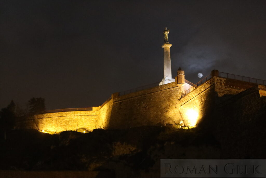
1. Gardos Tower

Description: The Gardos Tower is built on the site of a former Roman Fort. It is a central landmark located within the ruins of the medieval Zemun fortress, and offers panoramic views of the Danube and Belgrade.

2. Medieval Zemun Fortress

Description: The ruined footings of the medieval fortress indicate a square citadel with four circular towers. It was constructed directly over Zemun’s Roman fort, revealing the ongoing defensive history of the area.

3. St. Nicholas Church

Description: St. Nicholas Church, also known as St. Nikolajevska Church, is a historic Baroque style church which was completed in 1752. It stands on the site of a former wooden Serbian temple dating back to the sixteenth century.

4. Danube Promenade (Zemunski Kej or The Quay)

Description: This is the bustling riverfront promenade itself, perfect for strolls, dining at riverside restaurants and watching swans. Two thousand years ago, this was a busy Roman Navy port for the Classis Pannonica, whereas today it features walking and cycling paths along the Danube.

5. Big Square (Velig Trg) Outdoor Market

Description: This is the focal point for visitors and locals in Belgrade old town. The square is surrounded by picturesque buildings, cafes and shops. In the centre is the outdoor market featuring stalls with fresh fruit, vegetables and fish, and a taste of Serbian cuisine. it is the best place to shop for handmade crafts, antiques as well as bric-a-brac.

Located in front of the Outdoor Market is the Baroque style Catholic Church of the Assumption of the Blessed Mary, which was built in 1795 and stands on the site of a former 16th century mosque. Inside is the Baroque statue of the Black Virgin made from ebony, which stands beside statues of St. Peter and St. Paul.

6. Farmers’ Market (Zemunska Pyjaca)

Description: Just around the corner from Big Square is the Farmers’ Market selling fruit, vegetables, fish, plants, flowers and clothing.

7. Gospodska Street

Description: Gospodska Street in Zemun is a quaint and scenic road lined with delightful buildings, local shops and inviting coffeehouses in a pleasant and welcoming atmosphere.

8. Magistrate Square (Magistratski Trg)

Description: The Magistrate Building is the heart of old Zemun, and used to be the centre of Administration during the Austro-Hungarian period. There are other historic buildings to be found in the square.

9. Great War Island

Description: Great War Island is a short walk from the Danube Promenade, and is reached by a ferry. The island is located at the confluence of the river Sava with the Danube. It holds a Nature Reserve called Veliko Ratno Ostrvo. The island is accessible during the summer for beaches (Lido Beach) and birdwatching.

Name: The island sits on a strategic location where armies could position their artillery and launch attacks on to bombard Belgrade’s Kalmegdan fortress. This happened during the Ottoman Siege of 1521, the Serbian Uprisings of 1806 and during the Austro-Hungarian Empire’s attack on Belgrade in 1915.


Travel Tips

  • Best time to visit: Spring and Autumn for milder weather and fewer visitors
  • Photography hotspots: Garos Tower and Medieval Fortress footings, Danube Promenade, Big Square
  • Nearby attractions: River Cruises, Kalmegdan Fortress in Belgrade

Visitor FAQ

  • What is Zemun famous for?
    • Zemun is known for its historic Roman origins as Taurunum, the remains of its Medieval Fort and scenic views of the Danube.
  • Can I see Roman Ruins in Zemun?
    • There are no visible Roman ruins, because the Gardos Tower and the Medieval fortress occupy the site of the former Roman fort.
  • How far is Zemun from Belgrade city centre?
    • Approximately 30 minutes by bus.
  • Are there guided tours of Zemun’s historical sites?
    • Yes, local guides offer walking tours highlighting the Gardos Tower, medieval fortress and riverfront history.
  • Is Taurunum the same as Belgrade?
    • No. Taurunum corresponds to modern Zemun, while Belgrade developed separately from the Roman Fortress of Singidunum located nearby.
  • What was the role of Taurunum in the Roman Empire?
    • Taurunum served as a fortified military settlement and naval harbour supporting the Danube Frontier defensive system known as the Danube Limes. The Limes consisted of Roman Legions, Navy units and defensive walls all operating together in a tightly controlled structure.
  • Which Roman Province did Taurunum belong to?
  • Which Roman Roads connected Zemun?
    • The Via Militaris, also known as the Via Diagonalis, was the Roman Road from Belgrade to Constantinople. It passed along the southern bank of the Danube to Viminacium, then through Nis (Naissus), Sofia (Serdica), Plovdiv (Philippopolis) and Edirne (Adrianopolis). It was built during the 1st century, possibly by Nero and was 574 miles (924km) long. Excavations have revealed a two lane highway, 26 feet (8m) wide.

Quick Facts


Nearby Attractions

The Belgrade Fortress consists of the old citadel (Upper and Lower Town) and Kalemegdan Park

The Belgrade Fortress consists of the old citadel (Upper and Lower Town) and Kalemegdan Park

Sirmium Imperial Palace

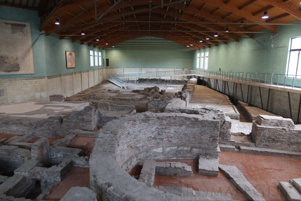
Sirmium. Excavation of part of the Imperial Palace. 18 Roman Emperors were born in or near Sirmium.

Viminacium reconstructed Amphitheatre and Gate

Viminacium reconstructed Amphitheatre and Gate

The Iron Gates is a series of Gorges on the Danube between Serbia and Roumania.

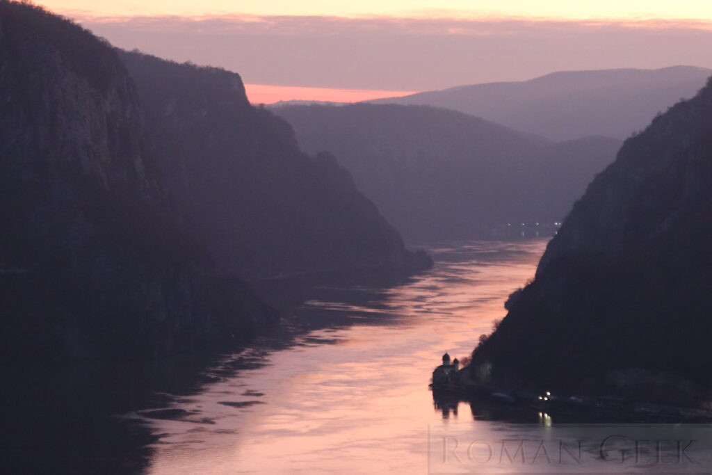
The Iron Gates are a series of Gorges stretching 83 miles (134km) on the River Danube, this is the Kazan Gorge.

Tangier

Roman Sites

  • Cotta Garum factory
    • Cotta is located on the Atlantic coast, 3 miles (5km) west of Tangier. It was the site of a Garum factory which is identical to a Garum factory at Lixus and at Baelo Claudia in Spain.
      • Olive Press
      • Temple
      • Villa
      • Baths

Museums

  • Kasbah Museum
    • Located at Place de la Kasbah, Tangier.
    • The museum holds collections covering all periods of Morocco’s history, including Finds from Roman Lixus and Volubilis.

Roman Roads


Tangier

Haidra

  • Haidra is a city in Tunisia, which holds the Ruins of Roman Ammaedara, which includes Forts, Baths and Mausoleums.
  • It was the Fortress for the Legio III Augusta, who based here in 30 BCE-75 CE, before being moved to Theveste and then Lambaesis in 128 CE. It was located in Africa Proconsularis.

Roman Sites

  • Arch of Septimius Severus (193-211 CE)
  • Mausoleum and Portico
  • Basilica of Melleus (4-6th century CE)
  • Byzantine Fort (c. 550 CE)


Haidra (Ammaedara)

North Channel

  • The North Channel, also known as the Straits of Moyle or the Irish Channel, lies between Northern Ireland and Scotland.
  • It connects the Irish Sea with the Atlantic Ocean.

Description

  • The North Channel is 21.4 miles (34.5km) long.
  • Its narrowest point is between the Mull of Kintyre (Scotland) and Torr Head (Northern Ireland) at 13 miles (21km).
  • Beaufort’s Dyke is a deep Trench within the North Channel that is 30 miles (50km) long, 2 miles (3.5km) wide and up to 1,000ft (300m) deep.
  • The Channel is distinguished by changeable weather and powerful currents and tides.

St. Georges Channel

  • St. Georges Channel is the Channel connecting the Irish Sea and the Celtic Sea.
  • It is defined as the narrowest point between Carnsore Point (Ireland) and St. David’s Head (Wales).


North Channel

Giant’s Causeway

  • The Giant’s Causeway is an area of vertical hexagonal Basalt Columns located 3 miles (4.5km) north of Bushmills in Northern Ireland. It was declared a UNESCO World Heritage Site in 1986 and is managed by the National Trust.
  • The columns lie at the foot of the cliff and lead into the sea. Some of the columns are also square, pentagonal, heptagonal as well as octagonal.

Similar Geological Structures

  • Structures with similar hexagonal Basalt columns exist in Scotland at:


Giant’s Causeway

Ulva

  • Ulva is a Scottish island in the Inner Hebrides located off the island of Mull.
  • It has vertical hexagonal Basalt columns, similar to the nearby island of Staffa, Drumadoon Point on the Isle of Arran and the Giant's Causeway in Northern Ireland.


Ulva

Sparta

  • Sparta is a modern town located in the Laconia Region of Greece in the Peloponnese.

Ruins of Ancient Sparta

  • Greek Theatre
  • Remains of the Walls
  • Tomb of Leonidas
  • Temple of Artemis Orthia
  • Menelaion, a shrine to Menelaus.

Museums

  • Archeological Museum of Sparta
    • Located at Agiou Nikonos, Sparta.
    • The museum holds a large collection of artefacts from the Neolithic to the Roman period, including the ‘Leonidas Statue’, a marble sculpture from c.480 BCE of a Greek Hoplite.

History of Ancient Sparta

  • The city is sited next to the Ruins of Ancient Sparta, the capital City and State in Ancient Greece.
  • Ancient Sparta had a powerful army and navy which put it in a position to lead the other Greek city states during the Greco-Persian Wars (499-449 BCE).
  • Greece was occupied by Rome in 146 BCE.
  • The city of Sparta continued as a tourist destination on the Roman Grand Tour in the Province of Achaea.
  • In 396 CE Sparta was sacked by the Visigoths under Alaric I, and the Spartan population was deported.

Spartan Society

  • Sparta, also spelt Spatha, was the only Greek city state to focus all its institutions on the primacy of the military.
  • Male citizens were trained for military service at an early age by a system called the Agoge, which concentrated on physical fitness, sport, military training and unswerving loyalty to Sparta.
  • Spartan Society was stratified into Spartan citizens with full rights, free citizens descended from Spartans, free citizens and a slave class called the Helots.
  • From the sixth century BCE, Sparta was governed by a Diarchy, two kings who ruled together.

Role of Sparta in the Greco-Persian Wars (490-479 BCE)

  • First Persian Invasion of Greece (492-490 BCE)
    • Battle of Marathon (490 BCE) and the rise of the Hoplight Phalanx.
    • The Athenians and the Plataeans defeated the Persians without the Spartans, who declined to fight with them until they had finished celebrating a religious festival. It was the only battle where the Greeks succeeded without the Spartans.
  • Second Persian Invasion of Greece (480-479 BCE)
    • Battles of Thermopylae and Battle of Salamis (480 BCE).
    • General Leonidas sent most of the Greek army south and remained to defend the Pass of Thermopylae to the death, with just 300 Spartans, 700 Thespians and 400 Thebans.
    • This was the first recorded Last Stand in history, where the Spartans famously held off the Persians for two days before they were annihilated to the last man.
    • However, despite losing the battle, the delay gave the Greeks time to withdraw and regroup at Salamis.


Archeological Museum of Sparta

Scapa Flow

  • Scapa Flow is a sheltered Bay in the Orkney Islands and is one of the Largest natural harbours in the world.
  • It was used as a Naval Base by the Royal Navy in both World Wars until it was closed in 1956 CE. The German Fleet was scuttled here after WWI.


Scapa Flow, Orkneys

Iram of the Pillars

  • Iram of the Pillars, also known as Ubar, is one of the Lost cities of antiquity mentioned in the Quran.
  • Opinion is divided as to whether Iram refers to a city or a region and its people.

History

  • Iram may have been a city during the Roman Period on the Incense Road.
  • If so, it may have been located in the ‘Empty Quarter’, a large desert in the south of the Arabian Peninsular, before being lost to desertification.
  • Ptolemy's Geographia refers to a city called Omanum Emporium, the capital of the ancient Kingdom of Oman, and which is thought to have possibly been Ubar or Iram of the Pillars.
  • Its location remains unknown.


The Sultanate of Oman