St. Albans: A Roman city beside a Medieval city in Hertfordshire
Overview
St Albans is a historic cathedral city in Hertfordshire, England, located on the River Ver, approximately 25 miles (40 km) north of London. The city is renowned for its rich Roman heritage, early Christian history, and its impressive medieval cathedral. Originally founded as the Roman town of Verulamium, St Albans became one of the most important settlements in Roman Britain. Today, the ruins of Verulamium can still be seen in Verulamium Park, situated below St Albans Cathedral.
Roman History
The Catuvellauni Tribe ruled one of the most powerful early Roman Client Kingdoms in Britannia. Under King Tasciovanus, and later his son King Cunobelin, referred to by Suetonius as the “King of the Britons”, the settlement flourished. After the Roman Conquest of Britannia in 43 CE, Verulamium had became a Roman Municipium, serving as the joint capital with Colchester of the Catuvellauni Tribe. Verulamium grew rapidly in importance, despite the town being destroyed during Boudicca's Revolt in 60 BCE, it was later rebuilt and continued to prosper as a key Roman centre.
Later History
Under the Saxon Kingdom of Essex, St. Albans became an administrative and religious centre when in 793 CE, it was given a Benedictine Abbey by King Offa of Mercia and a royal settlement nearby called Kingsbury. Unusually, the medieval town developed beside the Abbey and the Roman city remained vacant and was never reoccupied. Between 899-954, St. Albans became a frontier town opposite the Viking Danelaw with the river Lea acting as the boundary. During the Wars of the Roses (1455-1487) it saw two major battles. Under the Tudors it became famous as the residence of Sir Francis Bacon (1561-1626), the noted Philosopher whose works strongly influenced the Scientific Revolution. During the English Civil War (1642-52), St. Albans served as headquarters for the Parliamentary New Model Army under the Earl of Essex.
Walking Tour of St. Albans (2-3 hrs)
- Your geolocation will appear as a blue icon that moves on the map as you walk.
- You may start anywhere on the map and just follow the blue line to the next point of interest.
Things to Do and Places to See in St. Albans
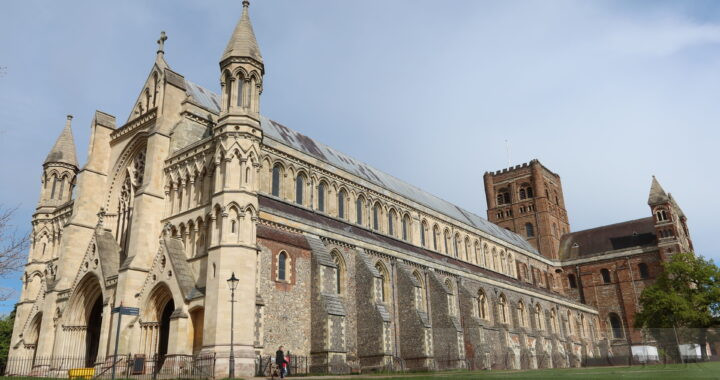
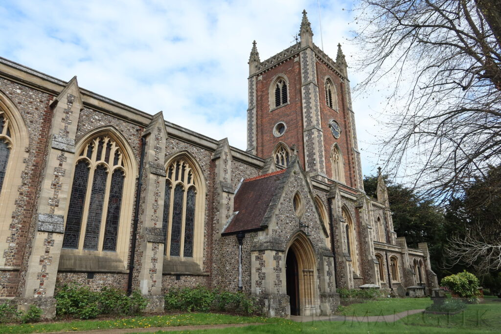
1. St Albans Cathedral
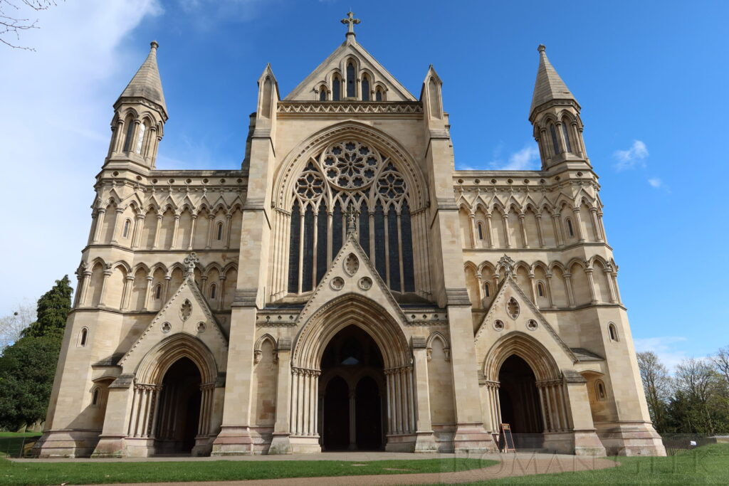
St. Albans Cathedral
Description: This is all that remains of the former Benedictine Abbey, founded as St. Albans Abbey by King Offa of Mercia in 793 over the shrine of St Alban. It was dissolved by Henry VIII in 1539, when the church was purchased by the town, becoming a cathedral in 1877. It has the longest Nave in England at 279 feet (85m) measured along the ceiling, although the longest Nave as measured along the floor is at Winchester Cathedral at 558 feet (170m).
Historical Insight: St. Alban is traditionally recognised as the first Christian martyr in Britain. He was not a Bishop but an ordinary soldier who lived in Verulamium during the 3rd to early 4th centuries CE. He is believed to have been executed between 209 and 313 CE, most likely during the Diocletianic Persecution (303–313 CE). His story is recorded in the medieval text Passio Albani, which also recounts a visit to his shrine by St. Germain, Bishop of Auxerre, in the 5th century CE. His martyrdom is also mentioned by early historians Gildas and Bede.
2. The Clock Tower
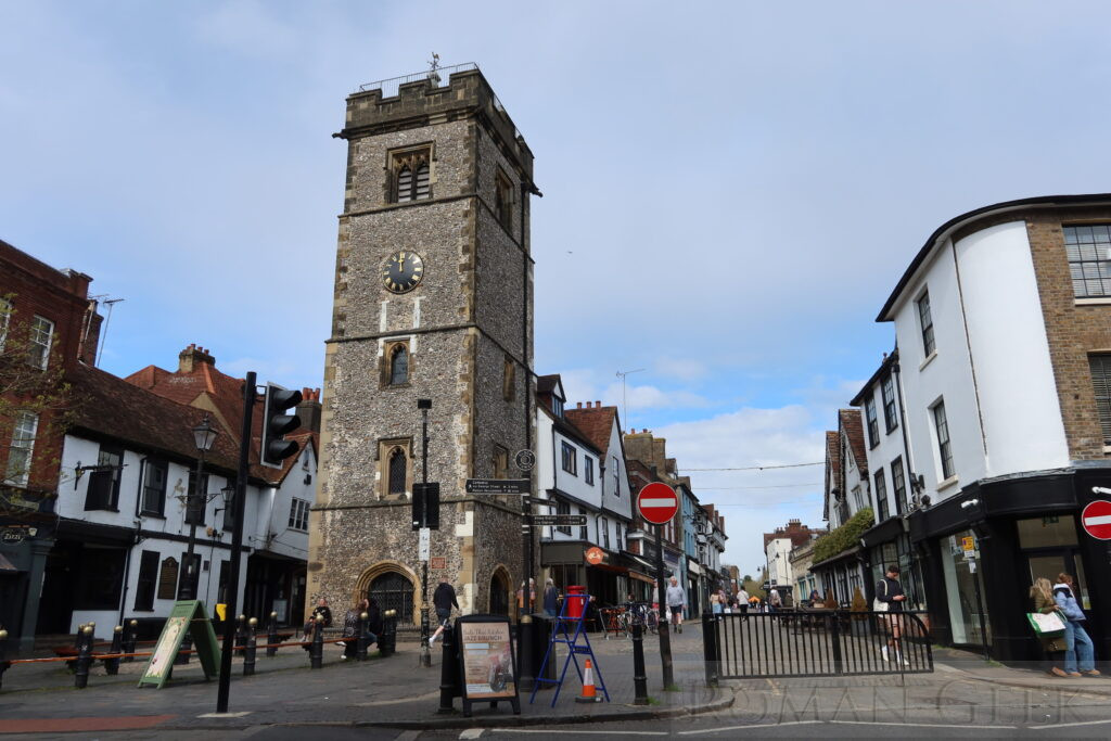
The Clock Tower, St. Albans
Description: Located in the High Street, it was built in 1412 and is the only 15th century Grade I listed secular Belfry in England, the other four being attached to churches. Unusually, the Belfry was built by the townspeople as a secular monument to challenge the power of the nearby St. Albans Abbey. The 600 year old bell is called ‘Gabriel’.
Tip: Visitors can climb 93 steep steps for panoramic views over St. Albans. The Tower is open at weekends between Easter and September.
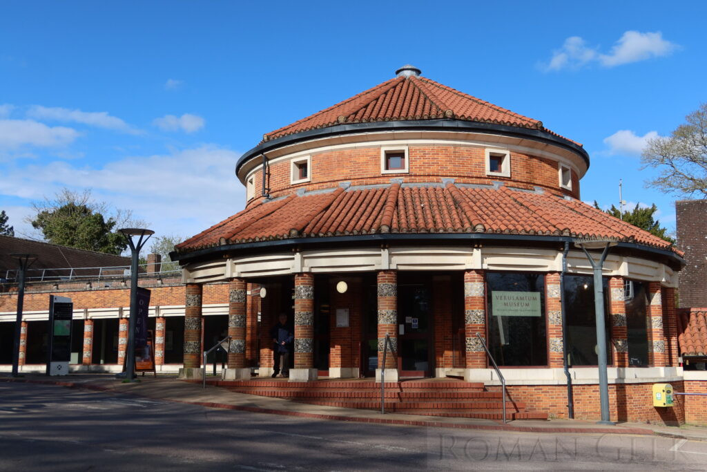
3. St Albans Museum and Gallery
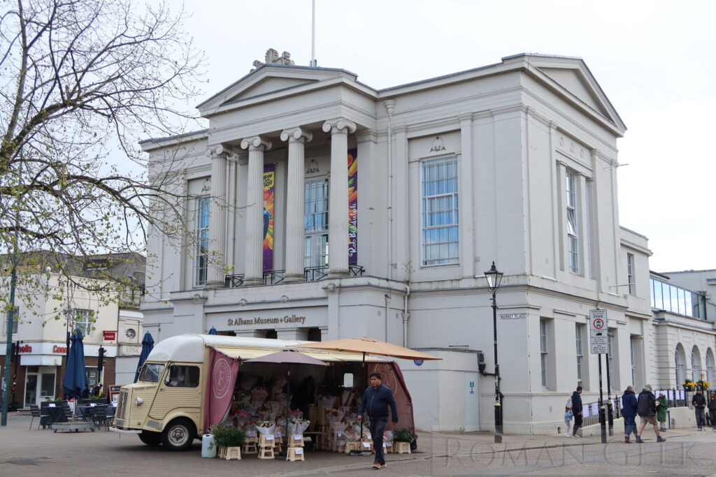
St, Albans Museum and Gallery
Description: The museum is located inside the restored Town Hall and presents the history and art of St. Albans. Access is free. Built in 1831, it has a Georgian Assembly Room with ornate chandeliers. There is a cafe and shop. The museum is run by St. Albans City Council and forms part of a collection of Museums and buildings in St. Albans. These include the Town Hall Museum, Verulamium Museum and Hypocaust, the Clock Tower and the ruins of Sopwell Nunnery.
4. Market Place
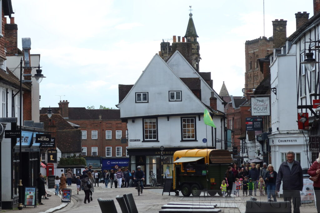
Market Place, St. Albans
Description: This is the historic city centre with many ancient buildings such as The Boot Pub (No. 4), a Grade II listed building built in 1500 , The Corn Exchange (Nos. 18-22), The Gable built 1637 (Nos. 13-15), Ye Olde Fighting Cocks Pub nearby
Also in nearby St. Peter’s Street was The Castle Inn, now gone. This inn was mentioned by Shakespeare as being where Yorkists killed the Duke of Somerset, the leading Lancastrian commander, during the Battle of St. Albans fought here during the War of the Roses in 1455.
At Numbers 8-10 in adjacent Chequer Street, the race horse trainer Tommy Coleman rebuilt the Chequer in 1826 and opened it as ‘The Turf’. Under his supervision it became a centre of gambling on local horse races. Coleman is credited with organising the first steeplechases in England, which took place at racecourses around St. Albans.
5. St. Albans Market
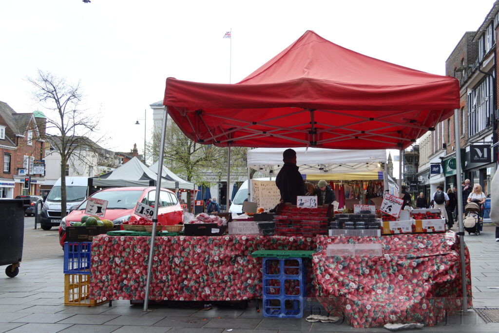
St. Albans Market
Description: This outdoor street market operates on Wednesdays and Saturdays (09:00-16:30) and extends from Market Place North to St. Peter’s Street. The market was established by Abbot Wulsin in 860 CE. There is also a Farmer’s Market once a month on a Sunday. The market has stalls offering fruit, vegetables, artisan goods, crafts and clothing.
6. St. Peter’s Church
St. Peter’s Church, St. Albans
Description: Located in St. Peter’s Street, the church was founded in 948 CE by Abbot Ulsinus of St. Albans Abbey. Its purpose was to receive pilgrims and prepare them for their visit to the shrine of St. Albans inside the Abbey, assisted by the churches of St. Stephen and St. Michael. Its appearance today is a result of rebuilding between the 13th-15th centuries.
Tip: The second wedding of Ricky and Bianca in the BBC soap opera Eastenders was filmed in this church.
7. Abbey Gateway
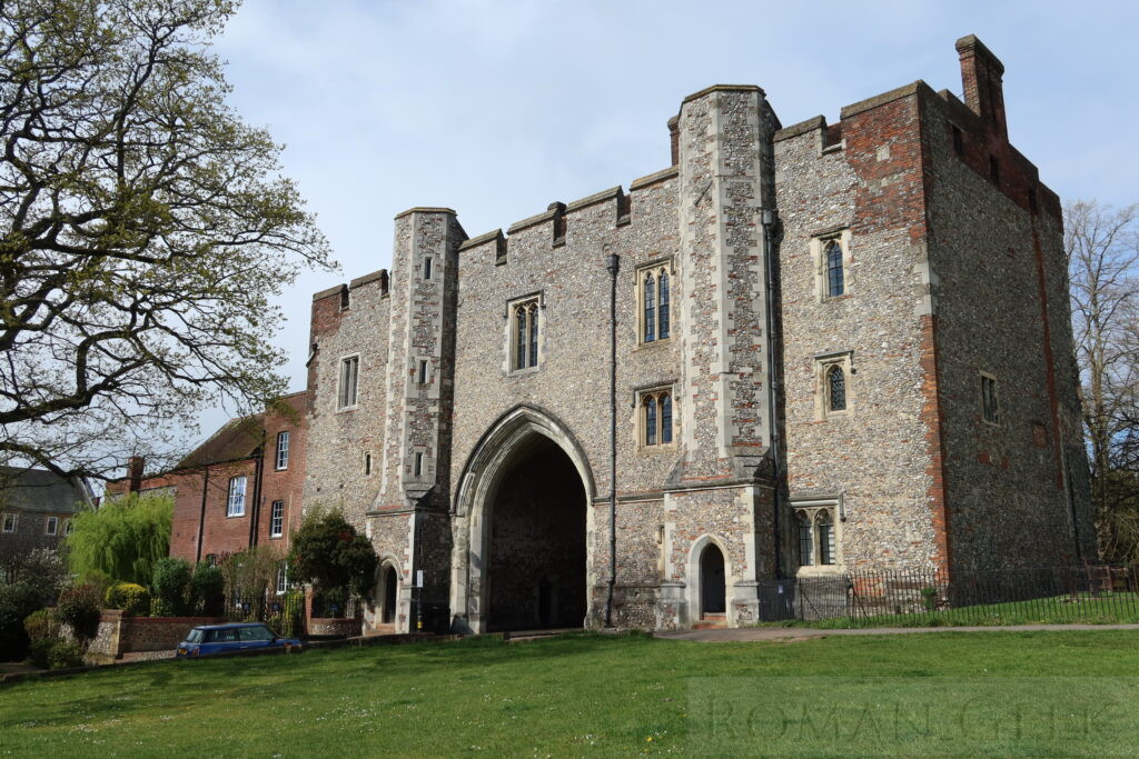
Abbey Gatehouse, St. Albans
Description: Built in 1365, this Gatehouse and the cathedral are all that remain of the once great Benedictine Abbey of St. Albans. In 1479, the Gateway housed the third printing press in England. Eight known works came from the Press, including a grammatical textbook ‘Elegantiolae’ by Augustino Datus.
8. Ye Olde Fighting Cocks
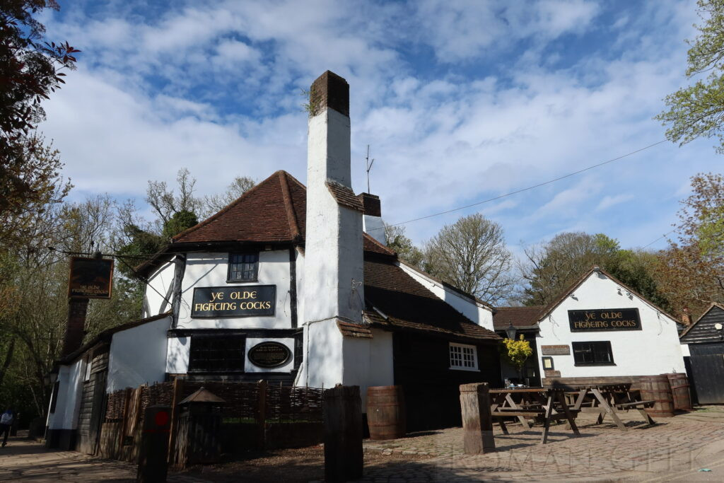
Ye Olde Fighting Cocks, St. Albans
Description: Located in Abbey Mill Lane beside the river Ver, this is one of several pubs that lay claim to being the oldest in England, and dating from the founding of the Abbey in 793 CE. However, this hasn’t been verified. The present structure is quaint and dates from the 16th century. Its octagonal shape suggests its origin as a cockfighting ring.
Tip: The Cocks featured in a 1990 episode of the ITV series Inspector Morse, ‘The Sins of the Fathers’.
9. Verulamium Park and Lake
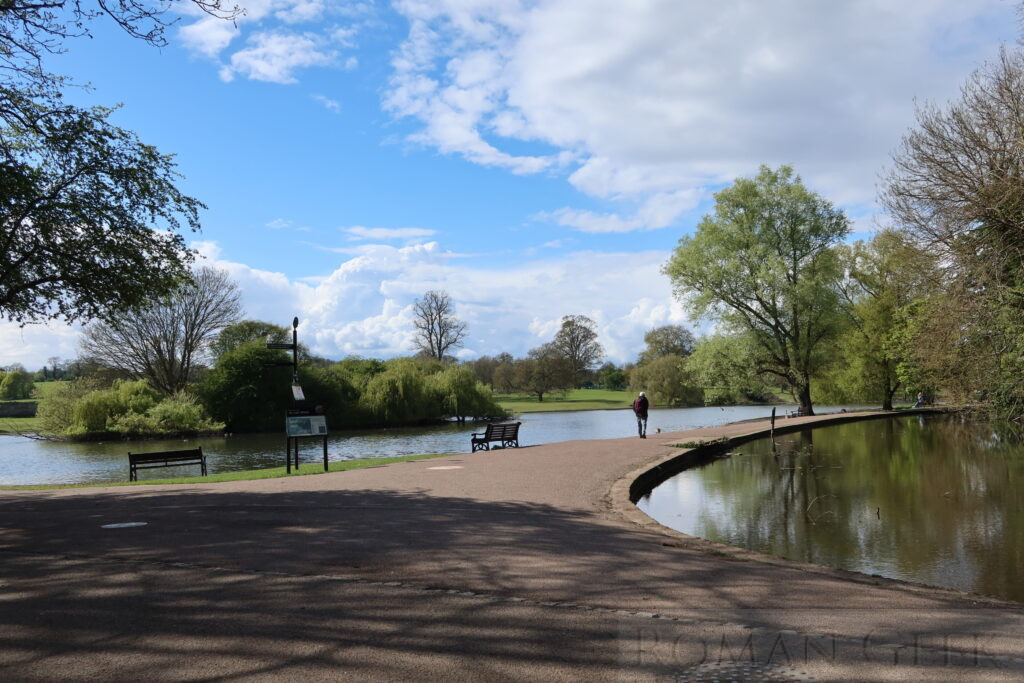
Verulamium Park and Lake, St. Albans
Description: Visitors can explore several well-preserved Roman archaeological sites in and around Verulamium Park, which is adjacent to the cathedral, including the Roman Wall, the Hypocaust and Mosaic, and the Verulamium Museum.
Historical Insight: The river Ver is a chalk stream that runs southeast through Verulamium Park from Kingsbury Watermill and alongside the lake. Over 85% of the world’s chalk streams are located in the South and East of England. The clear, nutrient-rich water maintains a steady temperature which supports a rich diversity of wildlife.
10. Watling Street
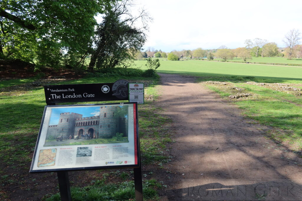
The London Gate, Watling Street, St. Albans
Description: Roman Watling street ran through Verulamium Park, from the London Gate to St. Michael’s church, where the Forum and Basilica once stood. Watling street is the A5 from London to Wroxeter, which has now been diverted away from the Town centre.
Historical Insight: The Romans held their frontiers with very small armies. But if one was attacked, the others would move quickly along the road system and join up with each other. When a rebellion occurred on the Rhine in 70 CE, the Legio XIV Gemina, based in Wroxeter, is recorded as marching along the Via Belgica to quell the Batavian Revolt. From Wroxeter they would have marched along Watling Street to Richborough, sailed across to Boulogne, and marched along the Via Belgica to Cologne.
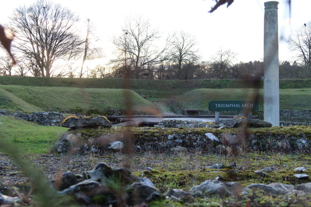
11. Verulamium City Wall
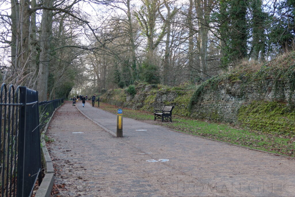
Verulamium City Wall, St. Albans
Description: After being razed during Boudicca's Revolt in 60 CE, the first wall was an earthen wall protected by ditches. The stone Roman Wall was built much later, between 265-270 CE, during the breakaway Gallic Empire (260-74). This was when Britannia, Gaul and Spain seceded from the Roman Empire for 14 years. The walls had a circuit of two miles (3km) with a height of 16 feet (5m). The foundations of the London Gate survive, along with two towers, and in places the wall still reaches a height of 12 feet (4m).
12. Roman Mosaic and Hypocaust
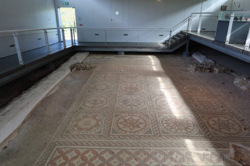
Roman Mosaic and Hypocaust, St. Albans
Description: Located in a separate concrete building, the entrance is free. The mosaic was in a large Roman town house built in 180 CE. The floor is thought to have been part of the reception and meeting rooms. The mosaic covered the Hypocaust, the underfloor heating system, and was made of 220,000 tesserae (small cubes) of cut stone or tile. It consists of multiple geometrical designs.
Roman Mosaic and Hypocaust, St. Albans
13. Verulamium Museum
Verulamium Museum, St. Albans
Description: The Verulamium Museum is located on the site of the Roman city and houses one of the finest collections of Roman artefacts in Britain. Exhibits include the reconstructed Verulamium Forum Inscription, Roman mosaics, Pottery and tools, jewelry and coins along with everyday objects from Roman Verulamium. The Dahlia mosaic has an intricate floral theme and the Shell mosaic features detailed geometric designs.
14. St. Michael’s Church

St. Michael’s Church, St. Albans
Description: St. Michael’s Church is built over the site of Verulamium Basilica.
Historical Insight: The church holds the grave of Sir Francis Bacon (1561-1626), Lord High Chancellor of England under James I and a noted Philosopher whose works strongly influenced the Scientific Revolution. The ‘Baconian theory of Shakespeare authorship’ arose in the 19th century and maintained that he wrote all or some of Shakespeare’s Plays.
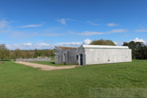
15. Verulamium Roman Theatre
Verulamium Roman Theatre, St. Albans
Description: The theatre was built within the walls of Verulamium around 140 CE, and had seating for 2,000 spectators. It was excavated in 1847 and during the 1930’s. Today, the Roman Theatre continues to operate, and is organised by the OVO Theatre Company, who host the Roman Theatre Open Air Festival. The Festival runs between June and August, with productions of comedies, music and Shakespeare’s plays.
16. The Waffle House, at former Kingsbury Watermill
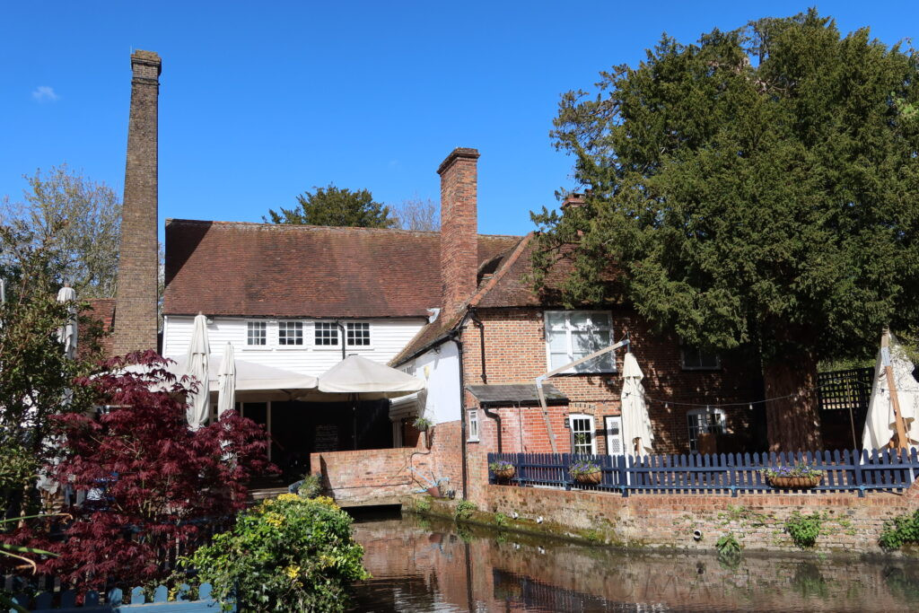
The Waffle House, Kingsbury Mill, St. Albans
Description: This a 16th century watermill on the river Ver. It has a Georgian facade and a Grade II listed Barn dating back to 1373. The breastshot waterwheel and two pairs of milling stones were restored in 1972. No longer a working mill, it is now occupied by a restaurant called the Waffle House, specialising in Belgian waffles. The workings of the mill may still be viewed inside the restaurant.
17. St. Michael’s Village
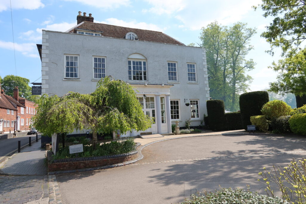
St. Michael’s Manor Hotel, St. Michael’s Village, St. Albans
Description: Now part of St. Albans, St. Michael’s village extends from near the Cathedral to the ancient St. Michael’s Church, along picturesque Fishpool Street. There are many 16th century buildings to be seen, including St. Michael’s Manor Hotel, with its own landscaped gardens and the Lake restaurant, characterful cottages with unique names such as Rivendell, Prigars Cottage and Hope Cottage, an old Pub with beams called the Rose and Crown, and other pubs such as the Lower Red Lion and the Six Bells. And the historic 16th century watermill on the river Ver, now operating as the Waffle House.
Further Afield
18. Clarence Park
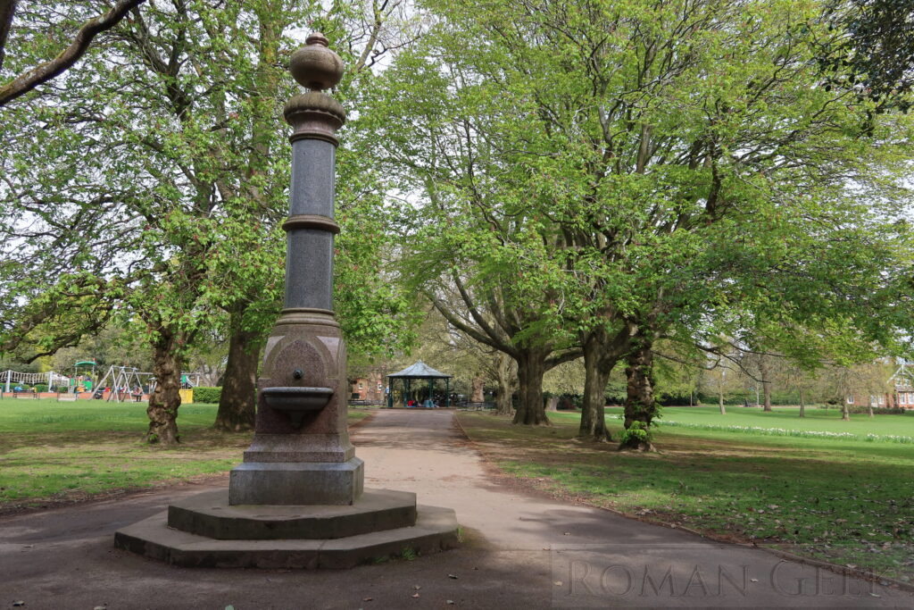
The Water Fountain, Clarence Park, St. Albans
Description: Clarence Park is a Victorian Park laid out as a Public Park and Municipal sports ground. It was donated to the town in 1894 by John Maple, and holds rose and flower beds, an impressive cricket pavilion, a granite drinking fountain and the park keepers lodge.
19. St. Albans South Signal Box Museum
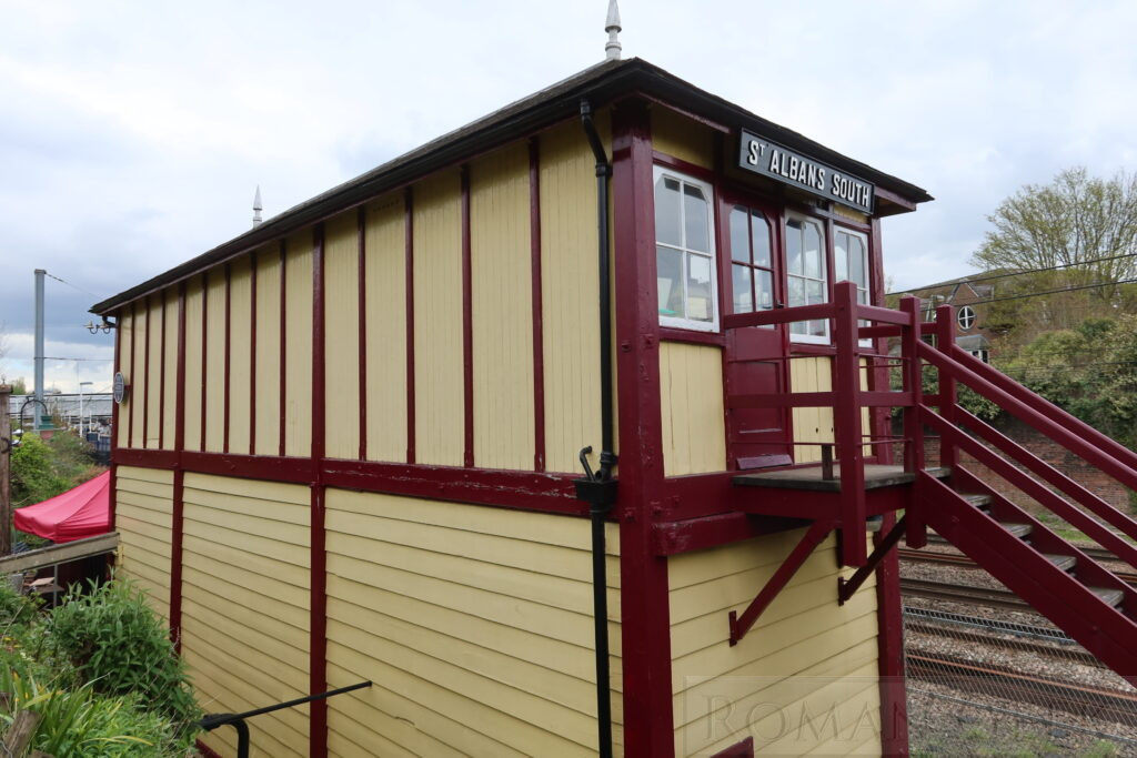
St. Albans South Signal Box Museum
Description: This is a Midland Railway Signal Box with a 44 lever frame dating from 1892. It is the largest signal box in preservation and the only example operating next to a working main line. The museum is open on selected Sundays between 1400-1700 and admission is free.
20. Lee House (Sopwell Nunnery)
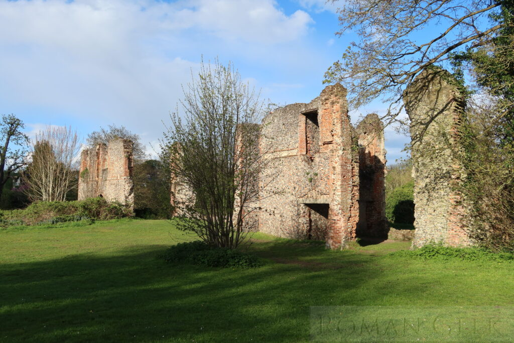
Lee House (Sopwell Nunnery), St. Albans
Description: Located in Cottonmill Lane, the site holds the ruins of Lee Hall, a Tudor country house built in 1550 by Sir Lee Hall on the site of a 12th century nunnery.
21. Abbey Theatre
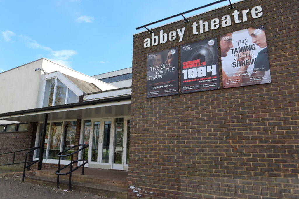
Abbey Theatre, St. Albans
Description: Home to the Company of Ten Theatrical Group, the Abbey Theatre seats up to 240 spectators and hosts regular performances from musicals to dramas.
22. St. Albans Organ Theatre
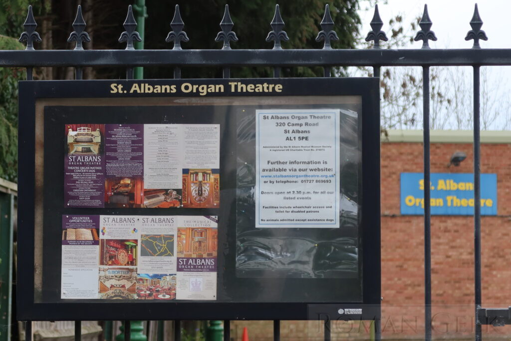
St. Albans Organ Theatre
Description: Located at 320 Camp Road, the premises of Charles Hart, who created a collection of 40 Belgian Dance Organs along with musical boxes, reproducing pianos, a Mills Violano, organettes, an orchestrelle and the Wurlitzer Pipe Organ from the Granada Cinema, Edmonton. He started his collection when jukeboxes started replacing organs in the 1960’s. The theatre is open for concerts on the second Sunday of each month.
Travel Tips
Visitor FAQ
- What is St. Albans famous for?
- Samuel Ryder, best remembered as the founder of the Ryder Cup, was also one of St Albans’ most notable citizens as a successful businessman, churchman and local politician. The Verulam Golf Club is the home of the Ryder Cup where Samuel Ryder was once a member.
- Two major battles of the the Wars of the Roses (1455-1487), took place here: The First Battle of St. Albans (1455) (Shakespeare’s Henry V, Part 2, ends with the conclusion of the battle) was won by Richard, Duke of York against the Lancastrian King Henry VI who was taken prisoner. At the Second Battle of St. Albans (1461), King Henry’s wife, Margaret of Anjou, defeated the Yorkist Earl of Warwick, recaptured Henry VI, but did not advance on London.
- St. Michael’s Church holds the grave of Sir Francis Bacon (1561-1626), Lord High Chancellor of England under James I and a noted Philosopher whose works strongly influenced the Scientific Revolution.
- The race horse trainer Tommy Coleman opened ‘The Turf’ in 1826. Under his supervision it became a centre of gambling on local horse races. Coleman is credited with organising the first steeplechases in England, which took place around St. Albans.
- The Roman Theatre Open Air Festival which holds performances between June and August.
- Can I see Roman Ruins in St. Albans?
- Yes, Roman walls, Hypocaust and a Roman Theatre. There are many Roman artefacts in Verulamium Roman museum.
- How far is Warner Brothers Studios from St. Albans city centre?
- Approximately 20 minutes by car.
- Are there Guided Tours of St. Albans historical sites?
- Yes, local guides offer walking tours highlighting the Cathedral, the Old Town and other venues.
- Is Verulamium the same as St. Albans?
- Yes, Verulamium was founded by the Romans in 43 CE, when they moved the Catuvellauni tribe from their Oppidum nearby.
- Which Roman Province was St. Albans located in?
- What was the role of Verulamium (St. Albans) in the Roman Empire?
- St Albans occupied a strategic position in the Roman road network. It was the first major stop on Watling Street to the legionary fortresses of Caerleon and Chester. And provided a direct road link to Cirencester via Akeman street.
- The River Ver, a tributary of the River Colne and ultimately the River Thames, is believed to have been navigable as far as Verulamium. This likely allowed Roman barges to transport goods between the town and the Thames valley network.
- Which Roman Roads connected to St. Albans?
- Was Verulamium mentioned in the Antonine Itinerary?
Quick Facts
- Modern Location: St. Albans, England
- Category: Historic city centre, medieval cathedral, tourist destination
- Activities: Walking tours, Sightseeing, Photography
- Nearby Roman Site: Welwyn Roman Baths
- Nearest Roman road: Watling Street
- Roman Province: Britannia
Nearby Attractions
- Hatfield House and Gardens
- Welwyn Roman Baths
- De Havilland Aircraft Museum, London Colney
- Tulleys Tulip Fields
- Gorhambury House
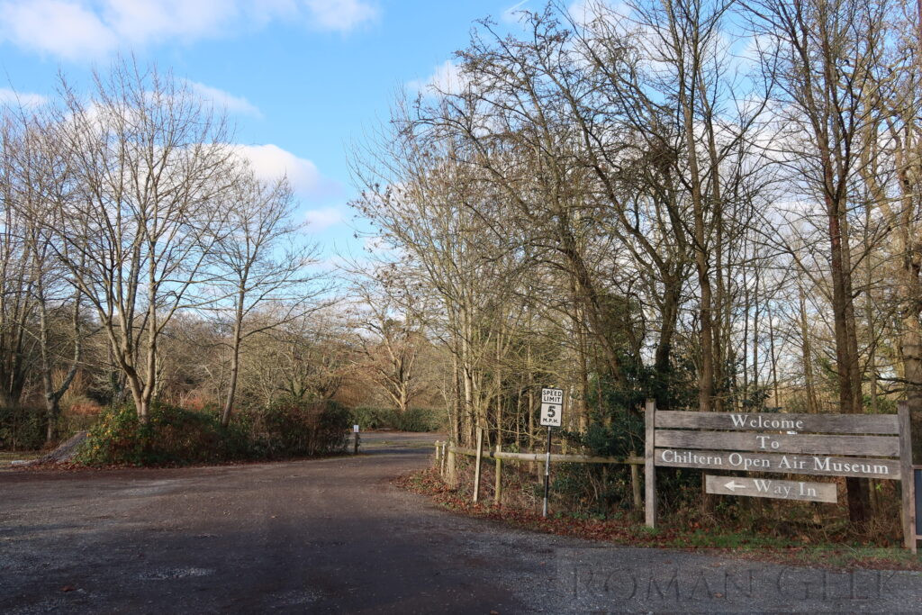
Chiltern Open Air Museum
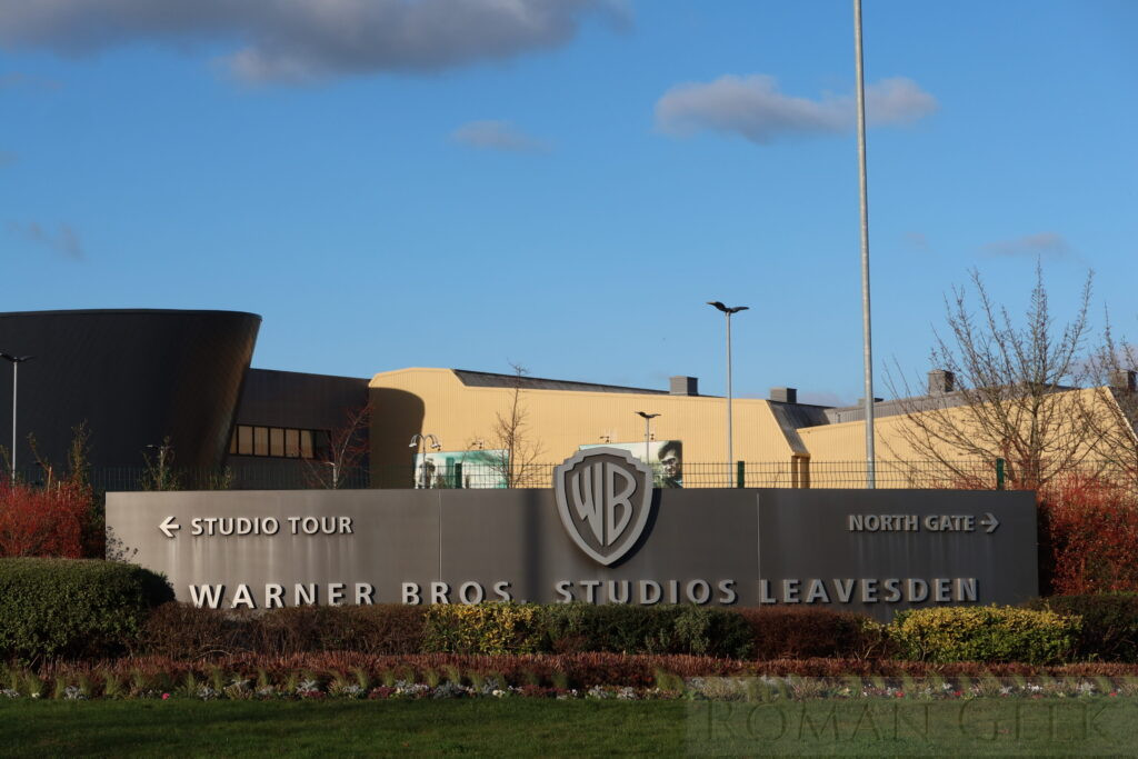
Harry Potter Studio Tour, Warner Bros. Studios Leavesden