Statue of Vercingetorix, Pl. de Jaude, Clermont-Ferrand

Clermont Ferrand

  • Clermont Ferrand is a cathedral city located on the River Tiretain near a chain of volcanoes in the Massif Central in the Auvergne-Rhone-Alpes Region of Southwestern France.
  • During the Gallo-Roman Period it was known as Augustonemetum and later, Arvernis, capital of the Arvernie Gallic Tribe in the Province of Gallia Aquitania. The remains of one of the largest Roman Temples in the Western Empire are located 5 miles (8km) to the west.

History

  • Strabo (c.64 BCE-c.24 CE) referred to the pre-Roman Oppidum as being called Nemessos, capital of the Arverni.
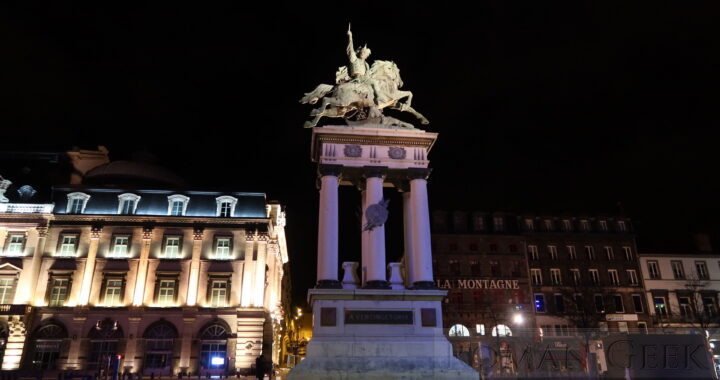
  • The Battle of Gergovia (52 BCE) was fought nearby between Julius Caesar and Vercingetorix (82-46 BCE), who was the Leader of the final resistance to the Romans and born nearby.
  • The cathedral was built over the Forum of the Roman city.
  • A nearby Volcano known as the Puy de Dome holds the remains of the Temple of Mercury, one of the largest Roman Temples in the Western Empire.

Museums

  • Bargoin Museum
    • Located at 45 Rue Ballainvilliers, 63000 Clermont-Ferrand.
    • The museum houses an Archeological section covering the Gallo-Roman Period.
  • Archeological Museum of the Battle of Gergovia
    • Located on the Plateau de Gergovie, 63670 La Roche-Blanche, 5 miles (8.5km) south of Clermont-Ferrand.
    • The small Museum contains models and artefacts and houses an audiovisual room recreating the Battle between Vercingetorix and Julius Caesar.

The Temple of Mercury

  • Puy de Dome Roman Temple of Mercury (c. 140 CE)
    • Located 7 miles (10km) west of Clermont-Ferrand, near the top of a volcano known as the Puy de Dome, are the ruins of one of the largest Roman temples in the western Empire.

Roman Roads


Clermond Ferrand

House of Archeology, Arras

Arras

  • Arras is a city located on the River Scarpe in the Hauts de France Region of Northern France.
  • The Romans knew it as Nemetacum, and later Atrebatum, capital of the Atrebates Gallic Tribe, located in the Province of Gallia Belgica.

Roman Sites

  • The Archeological Site of Nemetacum
    • 77 Rue Baudimont, 62000, Arras.
    • It holds the foundations of the city of Nemetacum, including a Sanctuary to the God Attis.

Museums

  • House of Archeology, in Arras.
    • 9 Rue de Whitstable, 62000, Dainville.

Roman Roads

  • A road ran from Arras to Cambrai, where it joined the Via Belgica.


House of Archeology, Arras

Strait of Otranto

  • The Strait of Otranto, known to the Romans as the Fretum Hydruntum (Otranto was Hydruntum), is the gateway into the Adriatic from the Ionian Sea.
  • It is 500 miles (800km) long and 45 miles (72km) wide at its narrowest point between Punta Palascia in Italy and Albania.

Roman Ferry across the Strait


Strait of Otranto

Oea

Roman Sites

  • The Arch of Marcus Aurelius in Oea.

Museums

  • Red Castle Museum or Assaraya Alhamra Museum
    • It is located in Tripoli Red Castle, Tripoli.
    • The Museum holds Archeological collections found in Libya that cover the whole historical period from the Phoenicians to the Modern Period.

Roman Roads


Arch of Marcus Aurelius, Oea, Tripoli

Great Chesters

  • Great Chesters was a Roman Fort on Hadrian's Wall called Aesica.
  • It was built over Milecastle 43.

The Roman Site

  • A large modern farm is located in the northeast corner of the site.
  • The base of the walls, gates, a turret and ditches are visible.

Auxiliary Units

  • Cohors VI of Nervians (2nd century CE)
  • Cohors VI Raetorum (c. 166 CE) (Raetians)
  • Cohors II of Asturians (3rd century CE) with a Vexillatio of Raeti Gaeseti (3rd century CE)

Roman Roads


Great Chesters

Burgh-by-Sands

  • Burgh-by-Sands is a village in the County of Cumbria, located on the south shore of the Solway Firth between England and Scotland.
  • It was the site of a Roman Fort called Aballava on Hadrian's Wall. No Remains of the fort are visible today.

History

  • King Edward I died near here in February 1307 CE, while on a Campaign against Scotland, and his body was laid in the Church before being taken to Westminster Abbey. A Monument to Edward I stands nearby.

Auxiliary Unit

  • Numerus Maurorum Aurelianorum
    • The unit is recorded as being here in an inscription from the 4th century CE.
    • They were a North African unit from Mauretania, modern Morocco.

Roman Roads


Burgh-by-Sands

Drumburgh

  • Drumburgh is a village near the south coast of the Solway Firth in the County of Cumbria.
  • It was the site of a Roman fort called Coggabata, which was part of Hadrian's Wall. The fort controlled a ford known as the Sandy wath, which crossed the Solway Firth at low tide from Drumburgh to Dornock in Scotland.

Drumburgh Castle

  • Medieval Drumburgh Castle now stands nearby, built entirely with re-used stone from the Roman Wall and Fort.

Ancient Crossings of the Solway Firth

  • Solway is from the Saxon words ‘Sol’ meaning mud, and ‘Wath’ meaning ford. Solway means muddy ford.
  • Farmers used the crossings to drive their cattle to markets, as did invading Armies in both directions.
  • These fords became passable at very low spring tides. The main crossings of the Solway were:
    • Bowness wath or Annan wath
    • Sandy wath
      • Drumburgh to Dornock in Scotland
    • Sul wath
      • Across the mouth of the river Esk
    • Peat wath
      • Across the mouth of the river Eden
  • Interestingly, another area of tidal flats with ancient crossings at low tides exists in the Bay of Mont Saint-Michel in Northern France.

Roman Roads


Drumburgh Castle

Cramond Roman Fort

  • Cramond Roman Fort was located on the river Almond where it joins the Firth of Forth in Cramond, a suburb of Edinburgh in Scotland.
  • It was Roman Caromago, a Fort and sea port for the Antonine Wall in Scotland.

Roman Site

  • Cramond Roman Fort only exists today as a ground plan.
    • The Site has been marked out in an open Park area with information panels to explain the Site.

Antonine Wall

  • This was a 39 mile (62km) long Turf and Stone barrier with Forts, connecting Old Kilkpatrick on the Firth of Forth with Carriden near Bo’ness on the Firth of Clyde.
  • Cramond Roman Fort would have supplied the Wall by sea.
  • It was located 100 miles (160km) north of Hadrian's Wall.

Museums

  • National Museum of Scotland
    • Located in Chambers Street, Edinburgh, Scotland.
    • On display is the ‘Cramond Lioness’, a Roman stone sculpture found nearby depicting a lioness mauling a prisoner.
    • Also on display is the Traprain Treasure.

Roman Roads


Cramond Roman Fort (ground plan)

Circus of Agonalis

  • The Circus of Agonalis, also known as the Stadium of Domitian, was completed in 86 CE and was where the ‘Agones’ or ‘Games’ were held in Rome.
  • It was located in the Campus Martius. The space has been preserved and is marked by an oval kerb around the Piazza Navona.

Getting There

  • Location: Piazza Navona, Rome.

Piazza Navona

  • The Piazza Navona is the former Circus of Agonalis, created by Domitian for chariot races and competitive athletics.
  • Originally, there was a stadium with seating for 20-30,000 spectators.
  • An oval kerb surrounding the square draws the outline of the former circus.
  • The Piazza holds three fountains:


  • Fontana dei quattro Fiumi
    • Meaning Fountain of the Four Rivers was created in 1651 for Pope Innocent X.
    • It holds the Agonalis Obelisk.
  • Agonalis Obelisk
    • In the middle of the fountain is a the Agonalis Obelisk or Obelisk of Domitian, which is a Roman copy of an Egyptian Obelisk, commissioned by Domitian.
  • Fontana del Moro
    • The fountain was created in 1575 and has a basin with four Tritons to which, in 1873, a statue of a Moor wrestling with a dolphin was added.
  • Fontana di Nettuno
    • The Fountain of Neptune was created in 1574 and the statue of Neptune was added in 1878.


Piazza Navona

Baths of Trajan

  • The Baths of Trajan in Rome, Italy, were built between 104-109 CE and up to then were the largest Baths in the city of Rome.
  • Today, only the curved Exedra of the Baths is still standing.

Getting There

  • Location: Via della Domus Aurea, 1, Rome.
  • Nearest Metro Station: Cavour, Line B.

Description

  • The Baths were supplied by the Aqua Traiana.
  • They covered an area 330 metres by 340 metres (30 acres).
  • Underground tunnels were used for servicing the Baths and the collection of water. The ‘Sette Sale’ or ‘Seven Rooms’ were cisterns which stored the water for the Baths.


Baths of Trajan