Aachen: Charlemagne’s city in western Germany
Overview
Aachen, also known as ‘Aix la Chapelle’, is a Cathedral and Spa town located on the river Wurm in western Germany. It was founded in 124 CE as the Roman Spa town of Aquaie Granni by Grenus, and was located in Germania Inferior. Aquae Granni contained Roman Baths based over Hot Springs.
History – Charlemagne and the Resurgence of the Roman Empire
Aachen is also noted for being the capital city of the first Holy Roman Emperor, Charlemagne (768-814 CE), who built his Palace over a Hot Spring. Charlemagne was crowned ‘Emperor of the Romans’ by Pope Leo III in Rome on 25th December 800 CE. This marked a revival of the Roman Imperial title in the West, as opposed to the title of ‘Basileus’ for Emperors in the Eastern Roman Empire. As King of the Franks, he established and ruled over a kingdom that spanned virtually all of western Europe, including what is now France, Switzerland, Belgium, The Netherlands, half of Italy and Germany, part of Austria and a small part of Spain.
Aachen Walking Tour
- Your geolocation will appear as a blue icon that moves on the map as you walk.
- You may start anywhere on the map and just follow the blue line to the next point of interest.
Things to Do and Places to Visit in Aachen
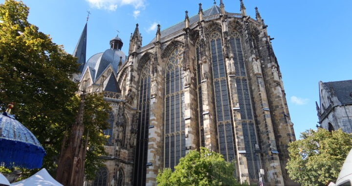
1. Westwerk Entrance of Aachen Cathedral
The Westwerk, main entrance to Aachen cathedral
Description: The Westwerk is the main entrance to Aachen cathedral. It has two bronze doors cast in 800 CE, known as the ‘Wolf’s Doors’. Charlemagne built Aachen Cathedral between 793-813 CE. It was constructed in the Carolingian-Byzantine style with a Gothic Choir. It is now a UNESCO World Heritage Site. In 814 CE, Charlemagne was buried in the Palatine Chapel at the centre of Aachen Cathedral, which bears an unusual octagonal design, with an octagonal domed roof. From 936 to 1531, the Palatine Chapel was the coronation place of the all the Holy Roman Emperors, which included thirty-one German kings and twelve queens. The cathedral Treasury hosts one of the most important collection of medieval artworks in Europe.
2. Elisengarten Park
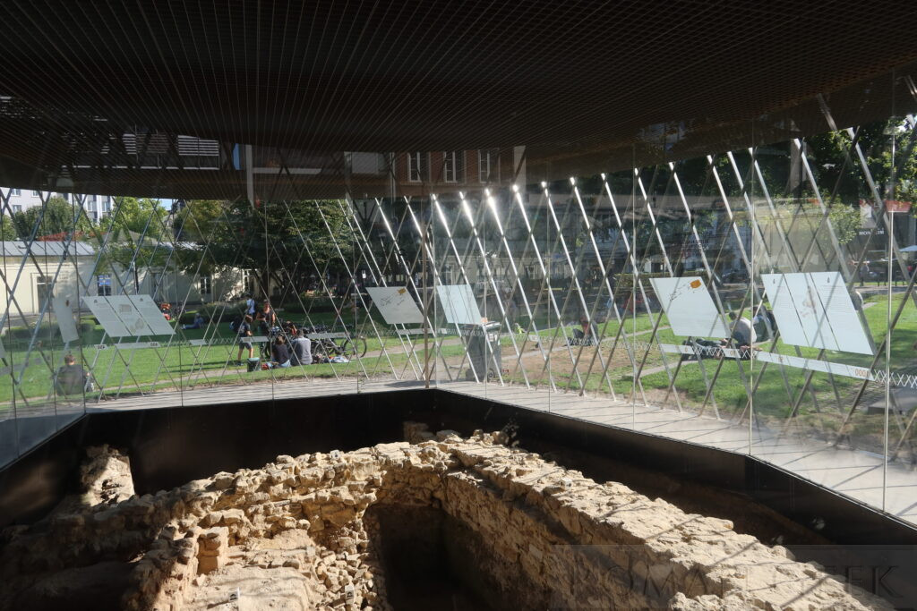
Elisengarten Park Roman Ruins, Aachen
Description: Roman Ruins (unspecified) are permanently on display in the Elisengarten Park on Hartmannstrasse, which is near Aachen Cathedral. The Elisengarten lies in front of the Elisenbrunnen Fountain and Pavilion.
3. Elisenbrunnen Fountain
Description: This Neoclassical building is built directly over a thermal spring. It consists of an open foyer with two Pavilions that hold two drinking fountains that gush hot thermal spring water at a temperature of 52 degrees C. The high sulphurous content is responsible for the unpleasant odour. People have been coming to Aachen for 2,000 years to ‘take the waters’ and enjoy their healing properties.
4. Couven-Museum
Description: Located at 17 Hunnermarket, the museum is located in a town house dating from the 1660’s. It features interior design styles from several periods including Rococo, Louis Seize (Louis XVI), Directoire, Empire and Biedermeier periods. The museum holds furniture from these periods and a fully restored 18th century pharmacy.
5. Hof Square and Roman Porticus
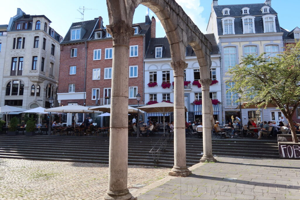
Replica Roman Porticus, Aachen
Description: Hof square, more of a triangle than a square, once held the Roman baths and temple area. It is now lined with atmospheric cafes and restaurants from where a replica Roman Portico can be admired. The original is in the Rheinisches Landesmuseum Bonn. Where Hof square meets Kramerstrasse, stands the Puppenbrunnen, a fairytale fountain sculpture built in 1975 that features bronze puppets with moveable parts.
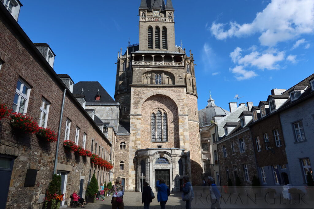
6. Aachen Town Hall and Granus Tower
Description: Located opposite Aachen Cathedral, the Town Hall was built in the Gothic style and completed in 1367. It served as the administrative centre for Aachen as well as the place to celebrate the coronation feasts of the new Emperors. The mayor of Aachen resides in the Town Hall. It is open to the public for guided tours during the day. The Town Hall is flanked by two medieval towers, the Granus tower built by Charlemagne in 788 CE as part of the imperial palace, and the Markt tower built in the late 1300’s.
7. Centre Charlemagne
Description: Located at 1 Katschof, the coutyard between the Cathedral and the Town Hall, this museum is dedicated to the history of the city of Aachen with emphasis on the role of Charlemagne.
Which Roman Road was Aachen on?
Roman roads linked Aachen to the towns of Maastricht and Heerlen. Both these towns were on the Via Belgica. This was Roman highway connected Cologne on the Rhine with Boulogne on the English Channel. The road was a link between the legions of Britannia and the legions on the Rhine.
Nearby Attractions
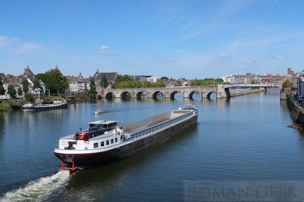
Saint Servatius Bridge, Maastricht
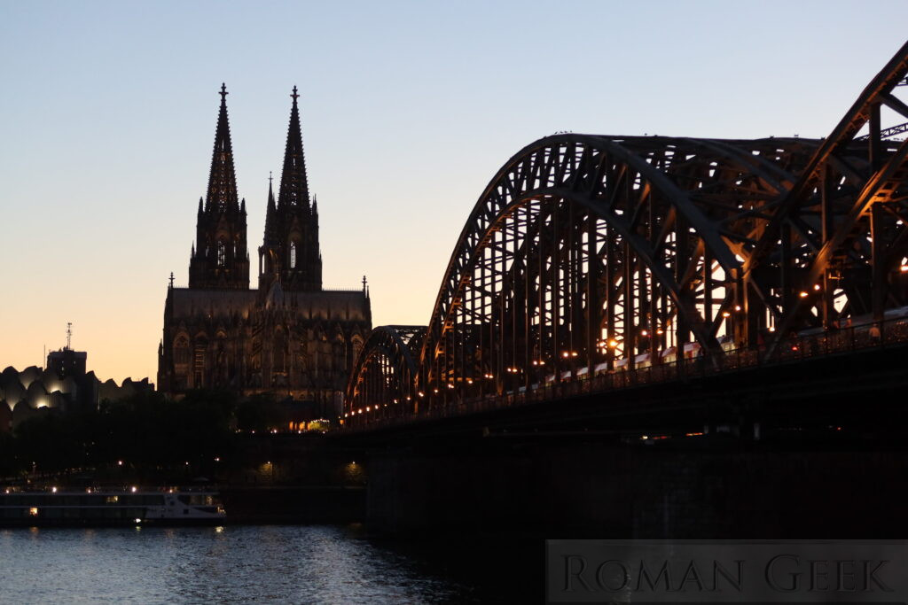
Cologne Cathedral and Railway Bridge
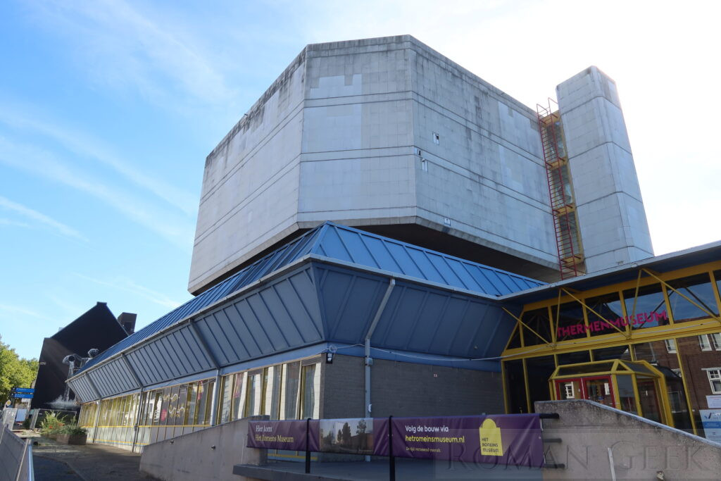
ThermanMuseum, Heerlen
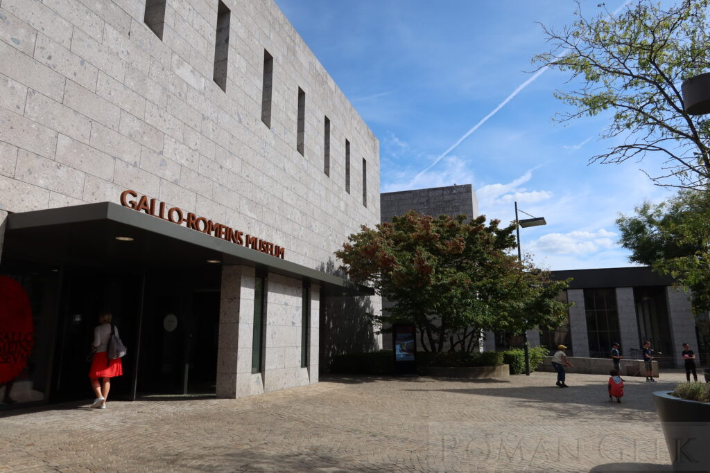
Gallo-Roman Museum Tongeren, Belgium