Minorca

  • Minorca is one of the Spanish Balearic Islands, which became part of the Roman Empire in 123 BCE and later joined the Province of Hispania Tarraconensis.
  • The name is from the Latin ‘Insulae Minor’, meaning ‘Minorica, the smaller one’ as opposed to ‘Majorica, the larger one’.

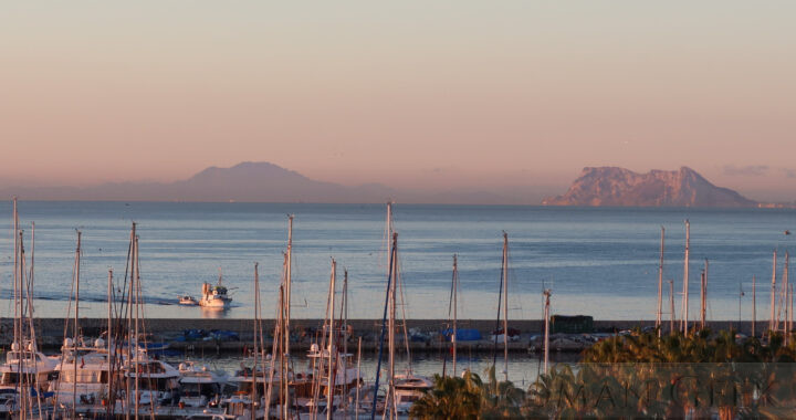
Insula Balearum (Balearic Islands)

Bronze Age Megaliths of Menorca and Majorca

  • The Taleoitic Culture built Chamber Tombs known as Navetas on Minorca, that resemble an inverted boat which date to between 3,300-1,200 BCE.
  • Later, 274 Megaliths called Talaiots were constructed between c.1,300-500 BCE and are found on both Minorca and Majorca.
  • They later constructed Megaliths called Taulas on Minorca that resemble table structures, between 500-300 BCE.

History

  • The Balearic Islands remained independent after the Fall of Carthage in 146 BCE, but in 123 BCE, the Roman Commander C. Caecilius Metellus conquered the Islands and founded the cities of Palma and Pollentia.
  • They formed part of the Province of Hispania Tarraconensis, forming the fourth division ruled by a Praefectus pro legato.
  • Under Diocletian (284-305 CE) and during the fourth century CE, they became a separate Province called Hispania Balearica.

Roman Sites

  • Sanisera Roman port city
    • The city was located on the natural anchorage for vessels in the harbour of Sanitja on the Cape of Cavalleria in the north of the island.
    • The site is a permanent archeological Dig and not open to visitors.

Museums

  • Ecomuseum of Cape Cavalleria
    • The museum is dedicated to underwater archeology, and holds artefacts from multiple shipwrecks such as amphorae and anchors found on the seabed of Sanitja harbour.
  • Museo de Minorca
    • The museum is located at Pla des Monestir, 9, Mahon.
    • The museum holds artefacts from the Roman period such as Amphorae, pottery and coins.


Menorca, Balearic Islands

Aurochs

  • The Auroch was a species of wild cattle which is now extinct, the last known animal having died in 1627 CE.
  • During the Roman Empire, Aurochs were the main Beast used in the slaying of animals in the Roman Amphitheatre, such as the Colosseum.

Name

  • Auroch, the plural is Aurochsen which is similar to Ox and Oxen.
  • They are also known as the ‘Urus’ and the ‘Wisent’ and are classified as ‘Bos Primigenius’.
  • The European Bison, the Wisent, is a separate and distinct species.

Distribution

  • Aurochs were distributed throughout Europe, Scandinavia, North Africa, Mesopotamia, India, China and Japan.
  • Auroch Fossils have been found in Buto and the Fayum in Egypt.


Fayum, Egypt


St. Denis

  • St. Denis, also known as Dyonisius, is the Patron Saint of France and one of the Patron Saints of Paris. He was martyred in c. 250 CE.
  • His Feast Day is celebrated on October 9th.

Decian Persecution (249-251 CE)

  • In early 250 CE the Emperor Decius (249-251 CE) passed an Edict which started the Decian Persecution.
  • According to Gregory of Tours, Pope Fabian (Pope between 236-250 CE) had sent seven Bishops from Italy with the aim of converting Gaul to Christianity. One of the seven was St. Denis who was sent to become the Bishop of Paris.
  • As a result of the Edict, Pope Fabian was martyred on the 20th January 250 CE.
  • St. Denis was also martyred, by beheading on a hill, later named after his martyrdom, ‘Montmartre’ (Mount of the Martyr). His two friends, Rusticus and Eleutherius who had accompanied St. Denis were also martyred with him.

Basilica of St. Denis

  • He was buried at a site 6 miles (10km) north of Paris, and the Basilica of St. Denis was built on the Site. The Kings of France were all subsequently buried here.


Basilica of St. Denis, Paris

Pontoise

  • Pontoise is a cathedral city located on the river Oise, a tributary of the river Seine, and is 17.5 miles (25km) from the centre of Paris. It is the capital of the Val d’Oise Department of France.
  • It was known to the Romans as Briva Isara or Pontisara and was in the Province of Gallia Lugdunensis. Although there are no surviving Roman monuments, Pontoise is noted for its medieval buildings and streets.

Museums

  • Museum of Pontoise
    • The museum specialises in items from the Medieval period.

Roman Roads


Pontoise

Nile Delta

  • The Nile Delta is the world’s largest river delta. It is a flooded savanna located down river from Cairo, where the Nile spreads out and drains into the Mediterranean Sea.
  • The Delta stretches 150 miles (240 km) from Alexandria to Port Said. In Ancient Egypt, this was the most fertile area for agriculture and the most heavily fortified, with every river mouth protected by forts.

Ancient Sources

  • Diodorus Siculus
    • ‘Bibliotheca historica’ Vol.1, Chapter 33.
    • Writing between 60-30 BCE, he stated that every mouth of the Nile had a fortified town on either side of the river mouth, equipped with defensive artillery.
  • Pliny the Elder (23-79 CE)
    • Natural History. He stated that the Nile had seven branches in the Delta. Today, only two exist.

The Seven Branches of the Delta

  • From West to East:
    • Canopic to Alexandria (defunct)
    • Bolbitine (Rosetta, still active today)
    • Sebennytic (defunct)
    • Phatnytic (Damietta, still active today)
    • Mendesian (defunct)
    • Tanitic (defunct)
    • Pelusiac to Pelusium (defunct)

Aswan Dam

  • Today, the Delta is shrinking as a result of Flood Control measures and the building of the Aswan Dam that limits river water reaching the Delta.
  • As a result, the Nile Delta only retains two of its original seven branches, the Damietta and the Rosetta.

Bird Migration

  • The Nile Delta is part of the East Africa Flyway bird migration route between Europe and Africa.
  • Millions of birds fly every year along this route and the Egyptian wetlands are critical stopover sites.


Nile Delta, Egypt

Ausonius

  • Decimius Magnus Ausonius (c.310-395 CE) was a Late Roman Politician, Poet and Tutor in Rhetoric from Bordeaux (Burdigala) in Gaul.
  • His most famous poem is a description of the river Moselle.

Career

  • Ausonius was brought up and educated in Bordeaux and Toulouse.
  • He accompanied his uncle when he became a tutor in Constantinople to one of the sons of Constantine I.
  • In 334 CE he worked for thirty years at the School of Rhetoric in Bordeaux, first as a Tutor, later progressing to become a Professor.
  • In the 360’s Valentinian I invited him to become the Tutor to his son Gratian (375-83 CE). He was made a Quaestor.
  • Between 368-9 CE Ausonius accompanied Valentinian I on his campaign in Germania.
  • In 375 CE, when Gratian became Emperor, he made Ausonius Prefect of Gaul, during which he conducted a war with the Alemanni.
  • In 379 CE Gratian made Ausonius a Consul.
  • In 383 CE, Gratian was assassinated by a usurper and Ausonius retired to his estates near Bordeaux, where he continued his writings until he died.

Mosella

  • His most famous poem is a description of the river Moselle

Water powered Stone Cutting Mill

  • Ausonius makes a brief reference to a Roman technological achievement, a water powered mill that was used to cut marble in the Moselle region.

Chateau Ausone

  • The Bordeaux winery claims to be on the former estate of Ausonius and continues a wine-making tradition started 2,000 years ago.

Notable Works

  • Epigrammata Ausoni (c. 120 epigrams)
  • Ephemeris (a type of diary in poetic form)
  • Parentalia (30 poems)
  • Epitaphia (26 epitaphs of the Trojan War Heroes)
  • Caesares (Discussion of the 12 Caesars by Suetonius)
  • Idyllia (20 poems which includes Mosella)
  • and many other works.


Chateau Ausone, Bordeaux

Nilometer

  • The Nilometer was an instrument that measured the height of the Nile in Egypt. It was usually a set of steps cut into the rock beside the Nile.
  • Records were kept of the annual rise and ebb of the Nile which in turn affected how the level of Taxation would be set.

Annual Rise of the Nile

  • Lowest level: June
  • Highest level: October
  • Records were kept from the time of the Pharaohs. Measuring the Nile enabled the Egyptian priests to announce the date of the first Nile Flood and the date of its maximum height. Taxation on agriculture was based on predicting how high the Nile would flood. On average, every fifth year, it would either be too excessive and destroy crops, or too low, and lead to drought. As it never rained in Egypt, everything depended on the Annual Flood of the Nile.
  • The waters of the Nile first rose as early as the beginning of June, and continued rising until September when the level stabilised for two to three weeks. The level rose once more during October, reaching its highest level, before declining to its lowest level, in June.

Mythology

  1. The Egyptians dated the Annual Rise of the Nile from the heliacal rising of Sirius. They based their four seasons around the rise and fall of the Nile. They believed the Nile rose due to the tears Isis wept for her deceased husband Osiris.
  2. The flood waters are due to the annual heavy rains at the sources of the Blue and White Niles, and the melting snow in the Ethiopian Mountains.

Types of Nilometer

  • A portable Nilometer consisting of a stick with heights marked off on it.
    • One was kept in the Serapeum, the Temple of Serapis at Alexandria. It was ritually brought out, and used to measure each rise in the Nile waters, before being returned to the Temple. Constantine I ordered it to be placed to rest in the church of Alexandria.
  • A column in the river with the heights of the water marked off at intervals.
  • A flight of stairs leading down to the Nile with the heights marked off along the stair wall.
  • A channel from the Nile through a conduit that led to a deep cylindrical well within a Temple building.
    • The Temple at Kom Ombo had this type of Nilometer.
    • The Temple at Philae Island had a Nilometer inside the Temple building.

Location of Nilometers along the Nile

  1. Elephantine Island:
    • near Aswan, it was located near the Nile Cataracts on the Frontier of the Kingdom of Kush (Sudan). It was therefore the first place in Egypt where the rise in the Nile could be recorded.
  2. In the Temples:
    • The Temple at Philae Island held a Nilometer.
    • The Temple of Kom Ombo had a Nilometer inside the Temple building.
  3. Cairo:
    • Another Nilometer existed near Cairo, where the Nile rose about a week later than at Elephantine Island.
  4. Alexandria:
    • the portable Nilometer in the Temple of Serapis.
  5. Edfu and Esna.


Elephantine Island, Egypt:

Gibraltar and Jebel Musa from Port of Estepona

Pillars of Hercules

Greek Mythology

  • In Greek Mythology they were created by Hercules whilst travelling to the Garden of Hesperides, as one of the Twelve Labours of Hercules. Instead of climbing the Atlas Mountains, he divided them, and connected the Atlantic with the Mediterranean Sea.

Plato

  • Plato stated that the lost empire of Atlantis was located beyond the Pillars of Hercules.

‘Non Plus Ultra’ and ‘Plus Ultra’

  • The Pillars were said by Renaissance historians to have had a message engraved upon them: ‘Non Plus Ultra’ meaning ‘Nothing further beyond’.
  • The Spanish King Charles V created his coat of arms depicting the Pillars of Hercules with the words ‘Plus Ultra’ meaning ‘Further Beyond’, in defiance of the old myth.
  • The Spanish Dollar also depicted the Pillars of Hercules as two vertical columns.
  • It is thought that the two vertical lines in the the American Dollar sign, originate from the Spanish Dollar, and therefore themselves depict the Pillars of Hercules.

The Temple of Hercules, Cadiz

  • Strabo described two bronze pillars eight cubits high in the Temple and states that they represented the true Pillars of Hercules.
  • This was located on an island adjacent to Cadiz and contained great wealth.
  • The Temple was visited by Hannibal before he invaded Italy, and later by Julius Caesar.
  • In 49 BCE Varro removed its wealth to nearby Cadiz.

Temple of Melqart, Tyre

  • Hercules was Melqart to the Phoenicians and Carthaginians.
  • The Temple of Melqart in Tyre was considered to be one of the most important temples in the ancient world.
  • Herodotus (c.484-c.420 BCE) wrote that he saw two columns in this temple, one made of pure gold and the other of an emerald stone that shone at night.


Strait of Gibraltar

Butrint

  • The Remains of the Greco-Roman city of Butrint is in Butrint National Park.
  • It is a UNESCO World Heritage Site located in the Vlore County of Albania, opposite the Greek island of Corfu.

History

  • It began as a Greek trading colony founded in 8th century BCE.
  • Butrint is built around a hill overlooking the Vivari Channel, which leads from the Straits of Corfu into Lake Butrint.
  • It became Buthrotum in 44 BCE when Julius Caesar made it a Roman colony.
  • In 31 BCE, Augustus made it the capital of the Province of Epirus and rebuilt the city after the Battle of Actium (31 BCE).
  • During the Middle Ages the city was Lost due to flooding caused by an earthquake.
  • Eexcavations started under Mussolini between 1928 until 1943. In 1944, The Albanian Communist Government came to power and continued the excavations under Enver Hoxha.

Butrint National Park

  • The Ruins and their surroundings are part of Butrint National Park.
  • It is located near the modern port of Saranda in Albania, opposite Corfu.
  • The Park can be reached either by Ferry from the Greek island of Corfu, or by Coach from Tirana in Albania.

Ancient Greek Sites

    • The Sanctuary
    • The Temple of Asclepius

Roman Sites

    • Defensive Wall
    • Lion Gate
    • Scaean Gate
    • Theatre
    • Roman Baths with Mosaic
    • The Forum
    • Roman Palace
    • The Nymphaeum
    • The Gymnaseum
    • The Great Basilica
    • There are many other buildings, houses and villas.

Museums

  • Venetian Castle Archaeological Museum
    • Located inside the Venetian Castle in Butrint National Park.
    • The museum holds a Collection of Artefacts, Sculptures and Mosaics and describes the history of Ancient Butrint.


Butrint National Park

Altinum

  • Altinum is the Ruins of a Roman city located opposite Venice in Italy.
  • It was rediscovered in 2009, where it was found buried in the marshes in a well preserved condition.

History

  • Altinum was a Roman Town which became a Municipium shortly before 131 BCE, around the same time as the nearby Via Annia was built between Atria and Aquileia.
  • Altinum was a Port with canals and had a Population between 20-30,000 people.
  • In 452 CE, its population fled the city to avoid the invading army of Attila the Hun and subsequently built Venice in the Lagoon.

Museum

  • The National Archeological Museum of Altinum
    • The footings of the main buildings and roads in the town have been excavated.

Roman Roads


Altinum Archeological Museum