Danube

  • The River Danube is the second longest river in Europe, after the Volga, at 1,777 miles (2,860 km) long.
  • The Source of the Danube is formed by the rivers Breg and Brigach, in the Black Forest, southern Germany. It runs through Eastern Europe and drains into the Black Sea.
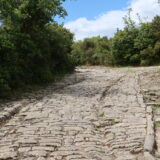
Danube Limes

  • The Danube was the Frontier with the Germanic Tribes during the Roman Empire.
  • Bulgaria where the Danube Delta drains into the Black Sea was conquered by the Romans in 75 BCE.
  • The Danube Limes was a Roman defensive system of walls and embankments to prevent incursions across the Danube.
  • The Danube River runs through the following modern countries:
    • Austria, Slovakia, Hungary, Croatia, Slovenia, Serbia, Bosnia and Herzogovina, Bulgaria, Roumania, Moldova.

Danube Delta

  • The Danube Delta is Europe’s second largest natural wetland, the largest being the Volga Delta.
  • It lies mostly in Roumania, and is a designated UNESCO World Heritage Site, with the remaining part lying in the Ukraine.


River Danube

Arch of Constantine, Rome

Arch of Constantine

Getting There

  • Location: Via di San Gregorio, Rome.
  • Nearest Metro Station: Colosseo, Line B.

Arches of Ancient Rome

  • It is one of the three surviving Arches of Ancient Rome.

Influence

  • Marble Arch in London is a 19th century copy located in Hyde Park. It was designed by John Nash, who built it in white Carrara marble and completed it in 1833.


Photo and map: Arch of Constantine

Bayonne Castle

Bayonne

  • Bayonne is a sea and river port located on the confluence of the Rivers Nive and Adour in the Nouvelle Aquitaine Region of Southwestern France.
  • During the Roman Period it was a walled city, possibly named Baiona or Lapurdum, in the Province of Gallia Aquitania, with a 4th century CE fort to guard the river crossing.

The Roman Sites

  • Bayonne Old Castle.
    • Three Roman Towers and the Roman city wall were incorporated into the Medieval Castle, which is on the site of a Roman Castrum.
  • Bayonne City Walls
    • The medieval Wall running down Rue Augustine, is built over the Roman Wall, with the medieval towers also built over the location of the Roman towers.
    • The outer walls surrounding the city date from the medieval period.
  • Rue D’Espagne
    • This road runs along the line of the Roman Cardo Maximus, the main north-south road in every Roman town.

Museums

  • Bayonne Basque Museum
    •  Located at 37 Quai des Corsaires, 64100 Bayonne.
    • This is a Museum and Library of the Basque People and Culture in France.

Roman Roads


Bayonne Castle

Baths of Diocletian, Rome

Baths of Diocletian

  • The Baths of Diocletian were the largest of all the Public Baths in Rome and could hold up to 3,000 people.
  • Known as Thermae, the Baths were built between 298-306 CE and dedicated by Diocletian in 306 CE. The Baths probably contained a Roman Library.

Getting There

  • Location: Viale Enrico de Nicola, 78, Rome.
  • Nearest Metro Station: Repubblica, Termini, Line A.

The Site today

  • The Baths are now incorporated into three buildings:
    • The Basilica of Santa Maria degli Angeli e dei Martiri (the Frigidarium).
    • The Church of San Bernardo alle Terme.
    • National Roman Museum


Photo and map: Baths of Diocletian, Rome

Vindolanda Roman Fort, Stanegate, near Hadrian's Wall

Vindolanda

  • Vindolanda Museum, also known as Chesterholm Museum, was a Roman Fort on the Stanegate, just south of Hadrian's Wall. It holds two reconstructed forts built in 1974, one of stone and the other of wood.
  • It is noted for a Find consisting of wooden writing tablets called the Vindolanda Tablets.

Vindolanda Tablets

  • This is a collection of thousands of wooden wax writing tablets that is now held in the British Museum in London.
  • They each contain letters written in ink describing the life of Roman soldiers in the Fort of Vindolanda and are dated between 85-102 CE.

Roman Site and Roman Army Museum

  • Roman Army Museum.
    • The museum holds Finds from the fort.
    • The Museum holds two reconstructions of the Vindolanda Roman Fort.

Roman Roads


Photo and map: Vindolanda Museum

Pont Ambroix Roman Bridge at Ambrussum, Lunel

Lunel

  • Lunel is a town located on the river Vidourle in the Occitanie Region of Southern France.
  • The Roman ruins of Ambrussum lie nearby and there was a Posting station on the Via Domitia which crossed the river Vidourle over the Pont Ambroix. Ambrussum was in the Province of Gallia Narbonensis.

Roman Sites

  • The Ruins of Ambrussum
  • Roman road with cart rut marks.
  • Posting Station, with Hotel and Baths and Taverns.
  • The Pont Ambroix
    • A Bridge carrying the Via Domitia over the river Vidourle, but with only one Arch remaining today.

Museums

  • Archeological Site and Museum of Ambrussum
Ambrussum Roman Museum, Lunel

Ambrussum Roman Museum, Lunel

Roman Roads

Roman Road, Ambrussum, Lunel

Roman Road, Ambrussum, Lunel


Roman Bridge at Ambrussum, Lunel

Split

  • Split is a port city built around a perfectly preserved Roman Fortress known as Diocletian's Palace (305 CE) located in the Dalmatia Region of Croatia. It is a Unesco World Heritage Site.
  • It was the Roman town of Aspalathos in the Province of Dalmatia.

History

  • The Roman Fortress was completed in c. 305 CE in time for Diocletian to retire there after he resigned as Emperor.
  • Salona, located five miles (8km) from Split, was the Roman Capital of Dalmatia.

Roman Sites

  • Diocletian's Palace
    • The Outer Walls
    • Th North Gate
    • The West Gate
    • The South Gate
    • The East Gate or Silver Gate
    • The Emperor’s Apartment, along the seafront
    • The Peristyle
    • The Palace Cellars
    • Mausoleum of Diocletian
      • which forms part of the Cathedral of St. Domnius inside the Palace.

Museums

  • Museum of Croatian Archaeological Monuments
    • It is located at Ulica Stjepana Gunjace bb, Split.
    • The Museum is dedicated to Medieval Croatian Finds between the 7th-15th centuries CE.

Roman Roads

Nearby Sites

Transport Hub

  • Today, Split is a transport hub. It is the second most important city in Croatia, after Zagreb.
  • Split Airport:
    • Flights operate from all over Europe, and Air Croatia runs up to five Domestic flights a day between Split and Zagreb.
    • Split Harbour is close to the Town Centre and Diocletian's Palace.
  • Airport Coach:
    • A frequent Coach service operates from Split Airport into Split Coach Terminal, which is adjacent to the Ferry Port and Railway Station.
  • Split Coach Terminal:
    • This has almost hourly coaches to Zagreb and Dubrovnik, with other Coach services operating to many destinations in Europe.
  • Split Ferry Port:
    • This has regular Fast Catamaran Ferries as well as a Car Ferry Service to the Islands such as Hvar. There are larger Ferries operating a Day and a Night crossing to Ancona in Italy during the Summer.
  • Split Railway Station:
    • Located beside the Coach and Ferry Terminal. There are no trains to Dubrovnik.
    • There is a morning Departure to Zagreb and a night train to Zagreb, with various local trains throughout the day.
  • Split Bus Station:
    • Located in the centre of town, the Bus Station has regular local buses to Solin, location of the Roman Ruins of Solina. Local Buses also go to the Medieval harbour town of Trogir.


Diocletian’s Palace, Split

Housesteads Roman Fort

Housesteads

  • Housesteads was a Roman Fort called Vircovicium located on Hadrian's Wall in Britannia.
  • The site is now a museum near Haydon Bridge, Hexham where the Finds are on display to the public.

Roman Site and Museum

  • Housesteads Roman Fort Museum
    • Finds from the site are on display in the museum including Altars, Jewelry, Tools and Weapons.
    • The Base of a Granary.
    • Latrines, in an excellent state of preservation.
    • Visitors can see the Floors and remains of the Buildings.

Roman Roads


Photo and map: Housesteads Roman Fort

Dura Europos

  • Dura Europos was a Roman border city and fortress, known as ‘The Pompeii of the Syrian Desert’, in the Roman Province of Syria.
  • The Ruins are located above the banks of the Euphrates near Salhiye in modern Syria,. It was held by the Romans between 164-257 CE. It defended against the Parthian Empire, along with Nisibis and Amida.

History

  • Dura Europos controlled the river crossing on the Euphrates, where the caravan route passed between Antioch on the Orontes, and Seleucia on the Tigris.
  • Dura Europos was founded by the Seleucid Empire c.300 BCE.
  • 113 BCE Parthian Empire captured Dura Europos.
  • 116-121 CE Trajan captured Dura Europos, but it was later retaken by the Parthians.
  • 164 CE until 256-7 CE Dura Europos became a Roman Border Fortress, garrisoned by the Cohors XX Palmyrenorum, facing the Parthian Empire, along with Nisibis and Amida.
  • It continually changed hands between the Parthian Empire and the Roman Empire.
  • In 256-7 CE it was abandoned after a successful Siege by the Sassanid Empire under Shapur I.
  • During excavations, amongst the parchments found written in Latin and Greek, was a Roman Puzzle, the Sator Square.

The Roman Sites

  • Synagogue and its wall paintings.
  • The House church
  • Mithraeum

Museums

  • Deir ez-Zor Museum
    • Located in Deir ez-Zor, Syria. It holds the Finds from Dura Europas and other sites in Syria.
  • Yale University Art Gallery (YUAG)
    • Yale University, New Haven, Connecticut, USA.
    • The University Museum holds Finds from all continents and all periods of history including from Dura Europos.

Roman Roads

  • Caravan Road to the East


Dura Europos: